Chapman, ME Land for Sale: 102 Acres with Gravel Road
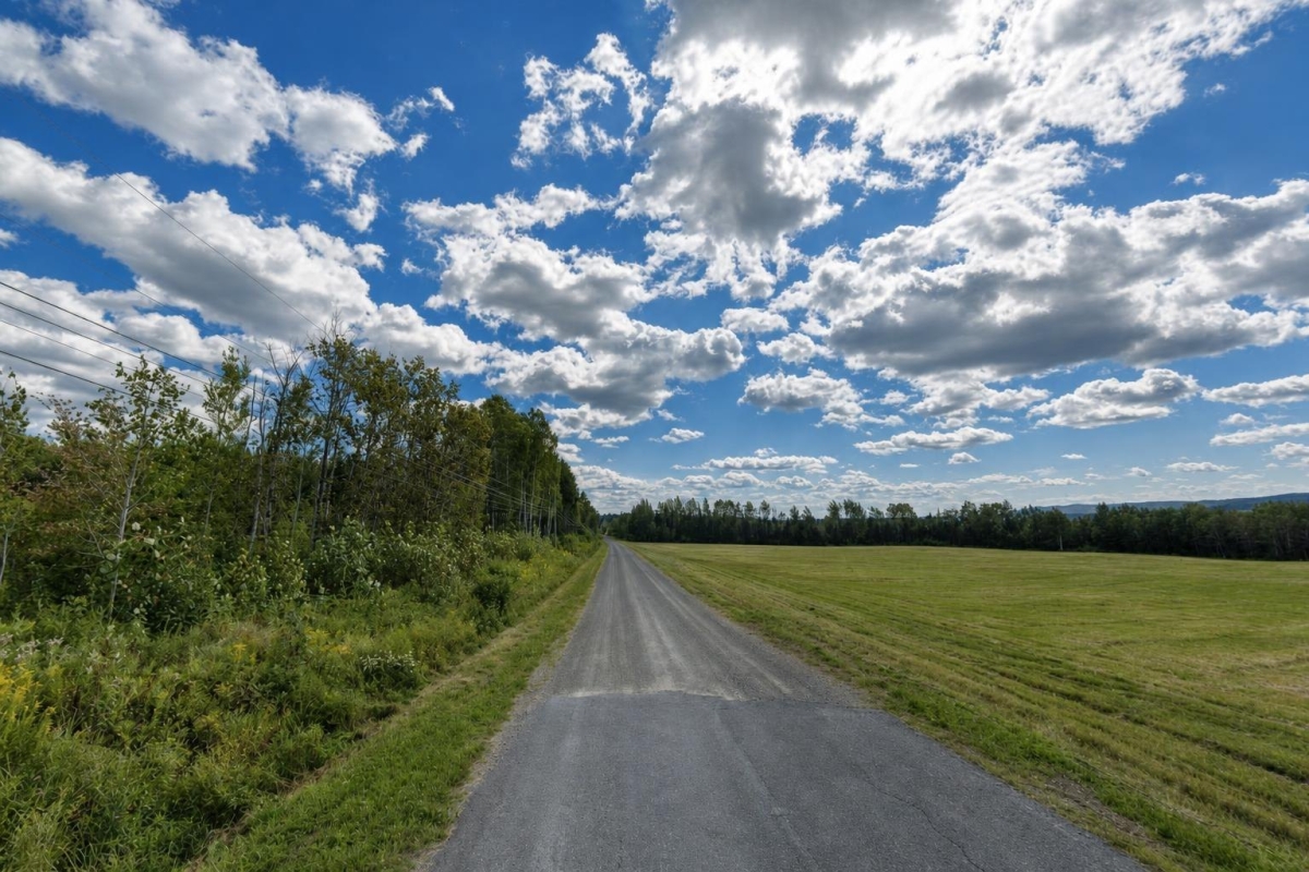
Large rural acreage in northern Maine can appeal to buyers who want room for a homesite, recreation, land stewardship, or a long-term hold. The key is separating what the listing confirms from what still needs local verification before you price improvements or plan a use.
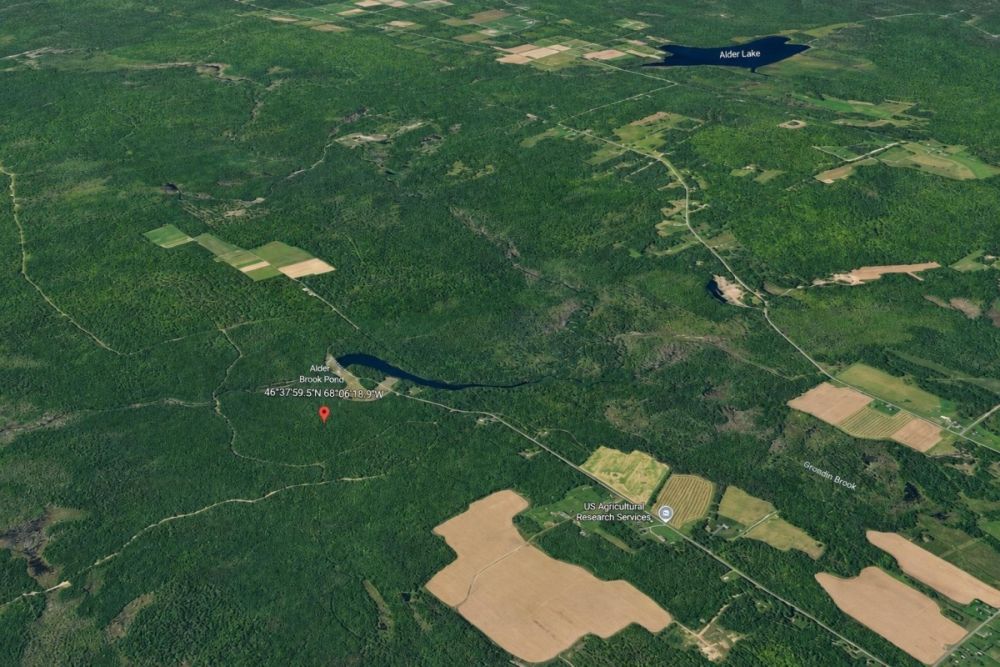
This vacant land listing is property number LC25791, a 102-acre parcel at 801 Carvell Rd in Chapman, Aroostook County, Maine. The cash price is listed at $100,000, and the legal description identifies Alder Brook Lake Estates, Lot 11, Tax Parcel 008-018-011.
The listing shows Residential/Rural zoning and gravel road access, but it does not confirm utilities, buildability, septic feasibility, flood status, road maintenance, or subdivision restrictions. Treat those items as required due diligence, not assumptions.
Property snapshot for parcel 008-018-011
These are the core facts supplied for the Chapman parcel, along with what each one means for a buyer evaluating the land.
Use these identifiers when asking for records, title information, tax history, GIS mapping, and zoning guidance.
Because the parcel is identified within a subdivision, buyers should ask whether any recorded covenants, road agreements, or association obligations apply.
This places the property in Chapman’s rural land market and helps focus due diligence on town, county, and Maine land-use resources.
The acreage is substantial, but usable area depends on boundaries, wetlands, soils, slopes, access, setbacks, and other site conditions.
The per-acre figure is useful for initial screening, but improvement costs and access or utility expenses can materially affect total cost.
This is a helpful holding-cost indicator, but the current bill, assessment, and any unpaid amounts should be verified before closing.
This is a first-pass zoning label only. It does not by itself prove that a home, camp, farm use, RV use, or subdivision is permitted.
Buyers should verify legal access, road maintenance responsibility, winter usability, power availability, water source options, and septic feasibility.
Chapman and Aroostook County setting
Chapman is a town in Aroostook County, Maine, within a rural northern Maine land market where large acreage parcels are commonly evaluated for privacy, recreation, timber, small-scale agriculture, and potential residential use. That general setting is helpful context, but it should not be treated as proof of what this specific parcel can support.
For this parcel, the verified location facts are the Chapman address, Aroostook County, Tax Parcel 008-018-011, and the Alder Brook Lake Estates Lot 11 legal description. Parcel-specific conclusions about frontage, buildable area, wetlands, slopes, seasonal access, and utility extension require map review, field inspection, and official confirmation.
Rural Maine land buyers should pay close attention to road status and maintenance. A gravel road can mean very different things depending on whether it is public, private, shared, deeded, seasonally maintained, or subject to a road agreement.
Potential uses and buyer fit
This 102-acre Chapman parcel may fit several buyer profiles, but each use should be evaluated through zoning, permits, title, access, utilities, water, septic, environmental mapping, and any recorded subdivision restrictions.
The listed Residential/Rural zoning and land categories suggest a broad rural-land opportunity, but the supplied data does not establish buildability or confirm any specific permitted use. Buyers should verify before clearing, building, farming, camping, hunting, leasing, or improving the property.
- Rural homesite or camp candidate, only if local rules allow the intended structure and the site supports legal access, driveway approval, well, septic, setbacks, and environmental requirements.
- Recreational acreage for personal outdoor use, subject to legal access, parking, local rules, hunting regulations, and any private restrictions or subdivision covenants.
- Small-scale agricultural, forestry, or land-stewardship use, depending on soils, drainage, timber conditions, clearing rules, wetlands, and applicable permits.
- Long-term land hold for a buyer comfortable with rural carrying costs, after confirming taxes, title, boundaries, access rights, and future-use restrictions.
Due diligence checklist before you make an offer
The parcel has enough scale to be interesting, but the most important buyer work is verification. Use the parcel number and legal description consistently when contacting officials, service providers, surveyors, and title professionals.
Confirm title, deed, and ownership chain
Order a current title search and verify that the Warranty Deed history, seller authority, parcel number, and Alder Brook Lake Estates Lot 11 legal description all match official records.
Verify boundaries and acreage
Parcel maps are useful, but they are not the same as a survey. Ask whether a survey, corner evidence, or boundary documentation is available, especially before placing a driveway, structure, fence, trail, or utility line.
Review zoning and permitted uses
Confirm whether Chapman local rules, Maine state land-use guidance, or both affect the parcel. Ask specifically about residential use, camps, agricultural use, RVs, accessory structures, setbacks, frontage, and driveway requirements.
Investigate legal access and road obligations
The listing notes gravel road access, but buyers should verify whether the road is public or private, whether access is deeded, who maintains it, whether it is usable year-round, and whether road agreements or fees apply.
Confirm utilities, water, and septic options
The supplied data does not confirm utility service. Check electric availability and extension cost, well options, septic feasibility, soil testing requirements, and whether any utility easements or permits are needed.
Check floodplain, wetland, shoreland, and habitat constraints
Large rural parcels can include constrained areas that affect building, clearing, driveway placement, and septic siting. Review flood mapping, wetland indicators, shoreland rules, drainage, and any environmental overlays.
Search for subdivision covenants or private restrictions
Because the legal description references Alder Brook Lake Estates, ask for recorded covenants, road maintenance terms, architectural restrictions, HOA or POA obligations, and any limits on camping, hunting, livestock, or short-term use.
Verify taxes and carrying costs
The listing shows annual taxes of $864. Confirm the current tax year, assessed value, unpaid taxes, special assessments, and whether the tax amount could change after transfer or improvement.
For official land-use and mapping context, the selected reference is Maine DACF’s LUPC Digital and Online Data resource. It is useful for checking Maine parcel, zoning, and planning map context where applicable, but buyers should still confirm parcel-specific questions with the town, county records, and qualified local professionals.
Financing and purchase structure
The supplied listing data shows a $100,000 cash price and does not list owner-financing terms for this parcel. If you plan to finance the purchase, discuss rural vacant-land lending early because lenders may evaluate access, utilities, zoning, survey status, and intended use differently than they would for a finished home.
A cash buyer should still budget beyond the purchase price. Surveys, title work, recording fees, road improvements, driveway work, utility extension, well, septic, permitting, and environmental review can meaningfully change the total project cost.
- Is the seller offering any terms, or is the listing cash-only as currently shown?
- Will a land lender require a survey, legal access confirmation, appraisal, or perc test?
- What closing costs, title costs, and recording costs should be expected?
- How much should be reserved for access, utilities, well, septic, and permitting if the goal is future residential use?
How to compare this Chapman acreage with other Maine land
At $100,000 for 102 acres, the listing calculates to about $980.39 per acre. That number is a useful screening metric, but it should not be the only comparison point. Two parcels with similar acreage can have very different real-world value depending on legal access, road quality, utilities, soils, wetlands, timber, restrictions, and buildable area.
When comparing Aroostook County or broader Maine land listings, look beyond acreage and price. Confirm whether each parcel has surveyed boundaries, year-round access, confirmed power, septic potential, clear zoning answers, and recorded rights that support your intended use.
Questions buyers may ask about this property and area
Bottom line on this 102-acre Chapman, Maine parcel
This is a sizable Aroostook County land listing with a clear parcel identifier, a stated $100,000 cash price, listed Residential/Rural zoning, gravel road access, and annual taxes shown at $864. Those facts make it a serious candidate for buyers who want rural Maine acreage at scale.
The opportunity should be evaluated with discipline. Utilities are not confirmed, buildability is not established, and the road, subdivision, environmental, and permit details need verification. The right buyer will treat the parcel number, legal description, and official records as the starting point, not the finish line.
If the acreage, location, and price fit your search, the next step is to review the full listing, request available documents, and line up title, mapping, access, utility, and zoning checks before making a final decision.
Ready to review the full property details?
See the complete LandCentury listing for current availability, seller contact options, images, and next-step purchase information.
Helpful buyer resources
Compare this parcel with other vacant land opportunities, review Maine land listings, and use official land-use resources to support your due diligence.

You Might Like

How to Start Investing in Real Estate with Less Than $1,000
So you want to get started in real estate investing, but you don't have a lot of money. Most people wrongly assume that you need a pile of cash to...

Main Advantages of Buying a Mobile Home; And Where to Find Cheap Ones
Mobile homes get a bad reputation, but a lot of people are turning to these affordable home options because housing prices are too high. A traditional stick built home has...
Jonesville, VA Land for Sale: 9.24 Acres with Paved Access & City Utilities
Buyer guide to parcel 36(15)1: 9.24 acres in Jonesville, VA with a $23,000 cash price and key checks.