Jordan Valley, OR Land for Sale: 10 Acres with Dirt Road
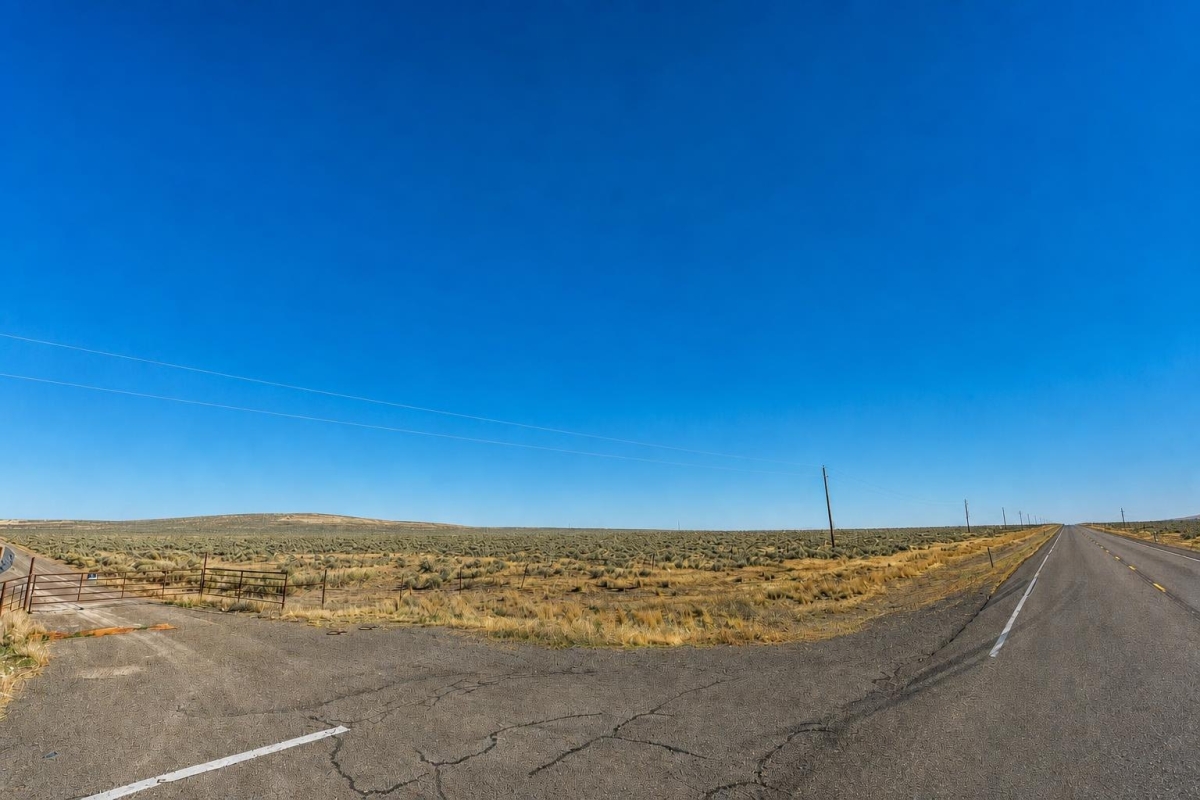
Rural Oregon land buyers usually start with the same core questions: can I reach it, what can I do with it, and what still needs to be verified before closing? This Malheur County parcel is best approached with that practical checklist in mind.
The property is a 10-acre vacant land tract on or near Dry Creek Rd in the Jordan Valley area, listed at a cash price of $8,000. The supplied listing identifies parcel number 32S41E3100300, Agricultural zoning, dirt road access, and a Warranty Deed.
The main caveat is important: the listing does not verify utilities, water, septic, power, legal buildability, road maintenance, or flood status. Those items should be checked through Malheur County records, planning staff, title review, and FEMA flood tools before a buyer relies on them.
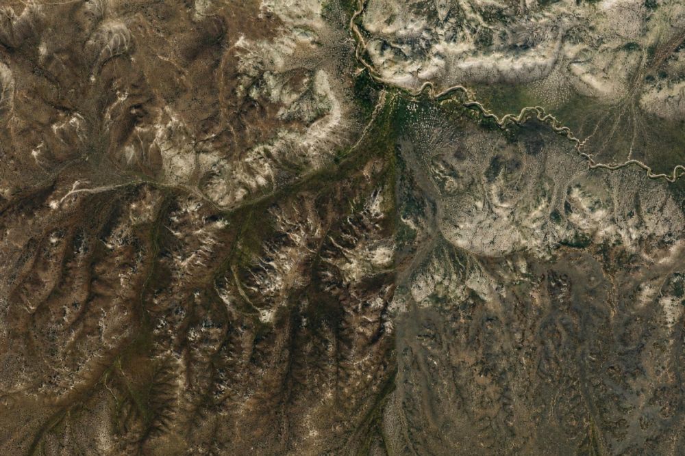
Property snapshot for parcel 32S41E3100300
These are the listing facts that matter most for a buyer evaluating rural land in Malheur County. Each item should be matched against official county and title records during due diligence.
There are no supplied building details, so the purchase should be evaluated as raw land with site improvements unverified.
This defines the scale of the tract and helps frame potential agricultural, recreational, and holding uses.
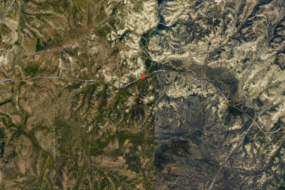
The road and community reference help with map research, but physical access and road status still need confirmation.
This is the key identifier for county assessor, GIS, taxlot, zoning, and title research.
The legal description helps tie the listing to survey and county records and should match the deed and title work.
Agricultural zoning may support rural land uses, but permitted uses, dwellings, structures, RV use, setbacks, and conditional approvals must be verified with the county.
Dirt access can affect vehicle type, seasonal usability, maintenance responsibility, and development feasibility.
The figure is supplied in the listing, but buyers should verify current taxes, assessments, and any delinquency directly in county records.
Jordan Valley and Malheur County setting
Jordan Valley is a small rural community in Malheur County in southeastern Oregon. The broader area is characterized by rural land-use patterns, agricultural zoning contexts, and large-parcel decision making where access, water, and county rules matter more than marketing descriptions.
For this specific parcel, the supplied facts place it in the Jordan Valley area with a Dry Creek Rd reference, parcel number 32S41E3100300, and a legal description in Section 31, Township 32 South, Range 41 East, Willamette Meridian. Those identifiers are more reliable for research than a general map pin or listing title alone.
Malheur County GIS and planning materials are useful for confirming the local zoning context, but they should not replace a direct check with county staff if you have a specific use in mind. FEMA flood tools should also be consulted because no flood-zone result is confirmed in the listing data.
Potential uses and buyer fit
This 10-acre tract is most relevant for buyers who are comfortable with rural land due diligence and who do not need utilities or buildability to be assumed from the listing. The Agricultural zoning label and recreational land category create possible use paths, but they are not guarantees of approval or suitability.
A buyer should evaluate any plan through Malheur County zoning rules, legal access records, title review, utility availability, water and septic feasibility, flood mapping, and any private restrictions or easements that may apply.
- Agricultural or rural holding use, subject to county zoning rules and any agricultural land-use limitations.
- Recreation-oriented ownership, subject to lawful access, seasonal road conditions, land conditions, and applicable state and local regulations.
- Possible future site planning, only after confirming legal access, permitted use, setbacks, water, septic feasibility, power options, and building permit requirements.
- Long-term ownership of rural Oregon acreage for a buyer who values low-improvement land and is prepared to verify taxes, title, and access before closing.
Due diligence checklist before making a decision
Use the parcel number, legal description, and county records as your starting point. The goal is to confirm that the land, access, and rules match your intended use before you close.
Verify parcel identity and acreage
Search county records using parcel number 32S41E3100300 and compare the taxlot, legal description, acreage, and ownership information to the listing and title documents.
Confirm zoning and permitted uses
The listing states Agricultural zoning. Ask Malheur County planning staff whether your intended use is permitted, conditional, prohibited, or subject to setbacks, overlays, or special approvals.
Confirm legal and physical access
The listing states dirt road access. Verify whether the access is legal, recorded, public or private, maintained, and usable for your vehicle or equipment during the seasons you expect to visit.
Research utilities, water, and septic
No utilities are confirmed in the supplied data. Ask the county and relevant providers about power extension, well feasibility, septic rules, prior approvals, utility easements, and any service constraints.
Check taxes, assessments, and liens
Do not rely only on the listing tax figure. Confirm current tax status, assessed value, special assessments, delinquent amounts, and liens through county records and title review.
Review flood and drainage risk
Use FEMA flood mapping as the official starting point, then consider drainage, seasonal water, wetland indicators, and site-specific conditions that may not be obvious from listing photos.
Order title review and consider a survey
A Warranty Deed is listed, but buyers should still review title for easements, encumbrances, reservations, access rights, and boundary certainty. A survey may be appropriate if exact corners matter.
The Malheur County Digital Research Room is the best single official starting point for parcel, taxlot, and legal-description research before contacting the assessor, planning department, or GIS staff.
Price and financing notes
The supplied listing shows a cash price of $8,000. No owner-finance price or owner-finance terms are provided for this property in the dataset.
If you are comparing this parcel with financed land, look at the total acquisition cost rather than only the down payment. Rural land buyers should also budget for title work, recording, any survey needs, site visits, utility research, and future permitting or improvement costs.
- Is the $8,000 cash price still current at the time of offer?
- Are there any document, recording, title, or closing costs in addition to the listed price?
- Will the seller provide current title information before closing?
- If third-party financing is used, will the lender require a survey, appraisal, access confirmation, or utility verification?
How to compare this parcel with other Oregon rural land
When comparing Malheur County land for sale, do not rank properties by acreage and price alone. Access, zoning, legal description clarity, water potential, septic feasibility, flood exposure, and title condition can matter more than the headline price.
This parcel has several useful identifiers supplied: parcel number, legal description, acreage, zoning label, road access label, and deed type. Its main unknowns are also clear: utilities are not verified, buildability is not established, road maintenance is unknown, and flood status is not confirmed. Those differences should drive your comparison checklist.
Questions buyers may ask about this property and area
Bottom line for buyers
This 10-acre Jordan Valley parcel offers a clearly identified rural Oregon land opportunity at a listed cash price of $8,000, with parcel number, legal description, Agricultural zoning, dirt road access, and deed type supplied in the listing package.
The property is not a shortcut around due diligence. Utilities are not confirmed, buildability is not established, and road maintenance or legal access details need verification. Those are normal rural-land questions, but they should be answered before you commit money to a specific use plan.
If the parcel fits your budget and location criteria, the next step is to review the full listing, verify the property in Malheur County records, and ask targeted questions about zoning, access, taxes, utilities, title, and flood status.
Interested in this 10-acre Jordan Valley parcel?
Review the listing details, then use the parcel number and legal description to begin official due diligence before making an offer.
Helpful next steps
Compare this parcel with other vacant land options, review county records, and prepare questions for planning, assessor, title, and utility contacts before closing.
You Might Like
Lovelock (Owner Financing $1,489.00 a month) Low Down Payment, NV Land for Sale: 287 Acres with Owner Financing
A practical buyer guide to 287 acres in Lovelock, NV with owner financing, APNs, access, utilities, and due-diligence checks.

Your Guide Finding Land for Sale in Holbrook, Arizona
Holbrook, Arizona is home to just over 5,000 people. Situated in Navajo County, the city was founded between 1881 and 1882. The town was formed when the main railroad was...
Scotts Crossing, TX Land for Sale: 20 Acres with Dirt Road
A practical buyer guide to LC25868: 20 acres near Van Horn with dirt-road access noted and utilities to verify.