Wells, NV Land for Sale: 640 Acres with Dirt Road
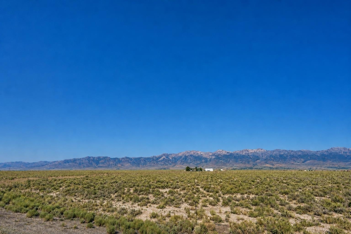
If you are looking for true large-acreage Nevada land, the decision is not just about price per acre. The real question is whether the location, access, zoning, water, utilities, and county records support what you want to do with the property.
LC25543 is a 640-acre vacant land listing in the Wells / Independence Valley area of Elko County, Nevada. The listed parcel number is 009-100-015, the cash price is $140,000, and the legal description is Section 29, Township 35 North, Range 64 East, MDB&M.
The listing shows Residential zoning and Dirt Road access, but the utility field points buyers to the county. Treat buildability, utility service, road legality, and flood status as due-diligence items until verified with official records and local departments.
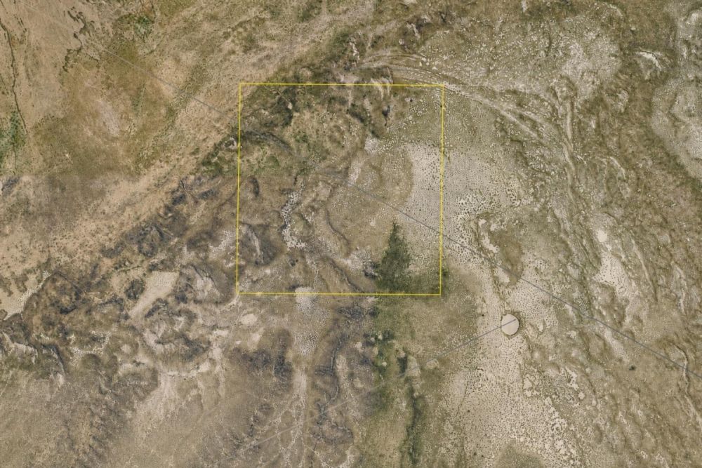
Property snapshot: what the listing says and what it means
These facts come from the supplied listing data. Zoning, access, utilities, taxes, and intended use should be checked against current county records before closing.
This is the key identifier to use when searching Elko County GIS, recorder, assessor, and tax records.
The deed type and legal description are important for title review, boundary research, and recorder-record verification.
This is a very large tract, so access routes, boundaries, water, and land-use rules matter more than they would on a small lot.
The coordinates help with GIS, flood, and mapping research, but exact boundaries should come from official parcel records.
Residential zoning is a starting point, not a buildability guarantee. Confirm permitted uses, setbacks, dwelling rules, and permits with the county.
A dirt road shown in the listing does not automatically prove recorded legal access, maintenance rights, or year-round usability.
The listing does not verify water, sewer, power, or utility extensions. Buyers should contact the county and relevant providers.
Useful for budgeting, but the tax year, current balance, assessment basis, and any special charges should be independently verified.
Setting: Independence Valley and rural Elko County
The parcel is presented as being in the Independence Valley area near Wells in Elko County. That is a parcel-specific listing fact; the exact boundaries, neighboring ownership, and access route should be pulled from county GIS and confirmed against the legal description.
General area context matters here because Wells sits in a rural, land-heavy part of northeastern Nevada. Large tracts can offer space and privacy, but they can also involve longer service runs, fewer nearby utilities, and more planning before any improvement project.
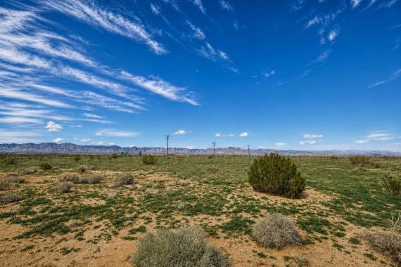
At 640 acres, scale is both the opportunity and the due-diligence multiplier. Before relying on maps or listing images, buyers should verify where usable access enters the property, how the parcel sits on the ground, and whether any physical constraints affect the intended use.
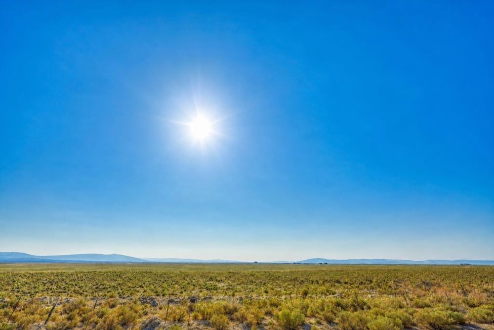
Potential uses and buyer fit
This property is most likely to interest buyers who want a large rural Nevada tract rather than a small platted lot. The listing is associated with agricultural/farm and recreational/hunting land categories, but categories are not permits and do not replace county approval.
Any realistic use depends on Elko County zoning interpretation, legal access, utility feasibility, water and septic options, environmental constraints, title review, and any private restrictions that may apply.
- Large-acreage land holding or long-term ownership, after confirming title, taxes, boundaries, and legal access.
- Residential homestead, cabin, or retreat concept only if county planning and building staff confirm the dwelling type, permits, setbacks, water, septic, and access standards.
- Recreational use planning, subject to county rules, fire restrictions, lawful access, waste disposal requirements, and any state or local regulations.
- Agricultural, grazing, or farm-style evaluation only after verifying permitted uses, water rights or water availability, fencing needs, access, and practical land conditions.
- Future parcel split or subdivision research only if Elko County rules, zoning, title, road standards, and survey requirements allow it.
Due diligence checklist before you rely on any plan
Use the parcel number, legal description, and coordinates as starting points, then verify each major assumption through official records, local departments, and qualified professionals.
Confirm the parcel in county GIS
Search parcel 009-100-015 and compare the mapped parcel to the legal description, coordinates, and listing location. Save or print the current county record for your file.
Review deed, title, and ownership records
The listing shows a Warranty Deed, but buyers should still review recorder records, deed history, seller authority, title status, and any liens or encumbrances before closing.
Get zoning and permit answers from the county
Ask what Residential zoning allows on this specific parcel, including dwelling rules, accessory structures, camping or temporary use rules, setbacks, subdivision limits, and permit requirements.
Verify legal and physical access
The listing says Dirt Road access. Confirm whether access is recorded, public or private, maintained, subject to easements, and usable for your intended vehicles and equipment.
Investigate utilities, water, and septic feasibility
Do not assume service is present. Ask the county and providers about electric service, water options, well requirements, septic feasibility, sewer availability, and the likely path for off-grid systems if needed.
Check taxes and assessment status
The listing shows $754.83 in taxes. Verify the tax year, current balance, assessed value, exemptions, special assessments, and whether any amounts are unpaid.
Screen flood, drainage, and environmental constraints
Use official flood mapping with the listed coordinates, then look for drainage patterns, washes, wildfire exposure, wetlands, conservation issues, or other constraints that could affect use.
Walk the land and consider a survey
A site visit can reveal access conditions, terrain, fencing, visible roads, and neighboring uses. If boundaries or development plans matter, consult a licensed surveyor.
The Elko County GIS Parcel Viewer is the best starting point for checking parcel 009-100-015 against local mapping and property data before moving deeper into title, zoning, and access questions.
Financing and cash-buyer planning
The supplied listing data shows a $140,000 cash price and does not show owner-finance terms. If financing is needed, treat it as a separate buyer task unless the seller updates the available terms.
Large rural land can be harder to finance than improved residential property. Lenders may look closely at title, access, appraisal support, intended use, and whether the property has utilities or improvements. Budget beyond the purchase price for due diligence, closing, title work, survey needs, travel, taxes, and utility or water investigations.
- Is the seller currently offering any financing, or is this a cash-only purchase?
- Will a lender finance an unimproved 640-acre rural parcel in this location?
- Will the loan require a survey, appraisal, title report, or access documentation?
- What cash reserve is needed for due diligence and post-closing land work?
How to compare this Wells parcel with other Nevada land
Do not compare this property only by price per acre. A 640-acre rural tract with dirt road access and utilities that require confirmation is a different purchase than a small platted lot with utilities at the street.
Compare parcels on parcel-record clarity, legal access, zoning specificity, water and septic path, tax burden, flood or environmental constraints, deed and title details, and the practical route to the land. The asking price only makes sense after those items are understood.
Questions buyers may ask about this property and area
Bottom line
This is a large Nevada land listing with clear core identifiers: 640 acres, parcel 009-100-015, Elko County, a $140,000 cash price, and a legal description tied to Section 29, Township 35 North, Range 64 East, MDB&M.
The value question depends on verification, not acreage alone. Residential zoning and dirt road access are useful listing details, but utilities, legal access, boundaries, flood status, taxes, title, and permits need independent confirmation.
If the parcel matches your goals, use the parcel number as your anchor, review the full listing, ask direct seller questions, and verify the official county records before investing in plans or improvements.
Ready to review the parcel details?
Open the full LandCentury listing for current availability, seller contact options, gallery details, and next-step information.
Helpful verification resources
Use Elko County GIS for parcel mapping, Elko County Recorder records for deed research, and FEMA flood mapping as part of your independent review.
You Might Like


Rural Investments: Finding the Best Value Farmland
Farmland has been invested in heavily in the past decade. Why? Prices were dirt cheap for a while, and the return-on-investment was substantial. Just over a year ago, and still...

How Non-Depreciating a Land Property Could Actually Be
Many investors get into land because they know that the land will always hold some value. Whether this value goes up or down depends on the markets, but land cannot...