Kearneysville, WV Land for Sale: 3.41 Acres on Leetown Rd, Rural Zoning Listed
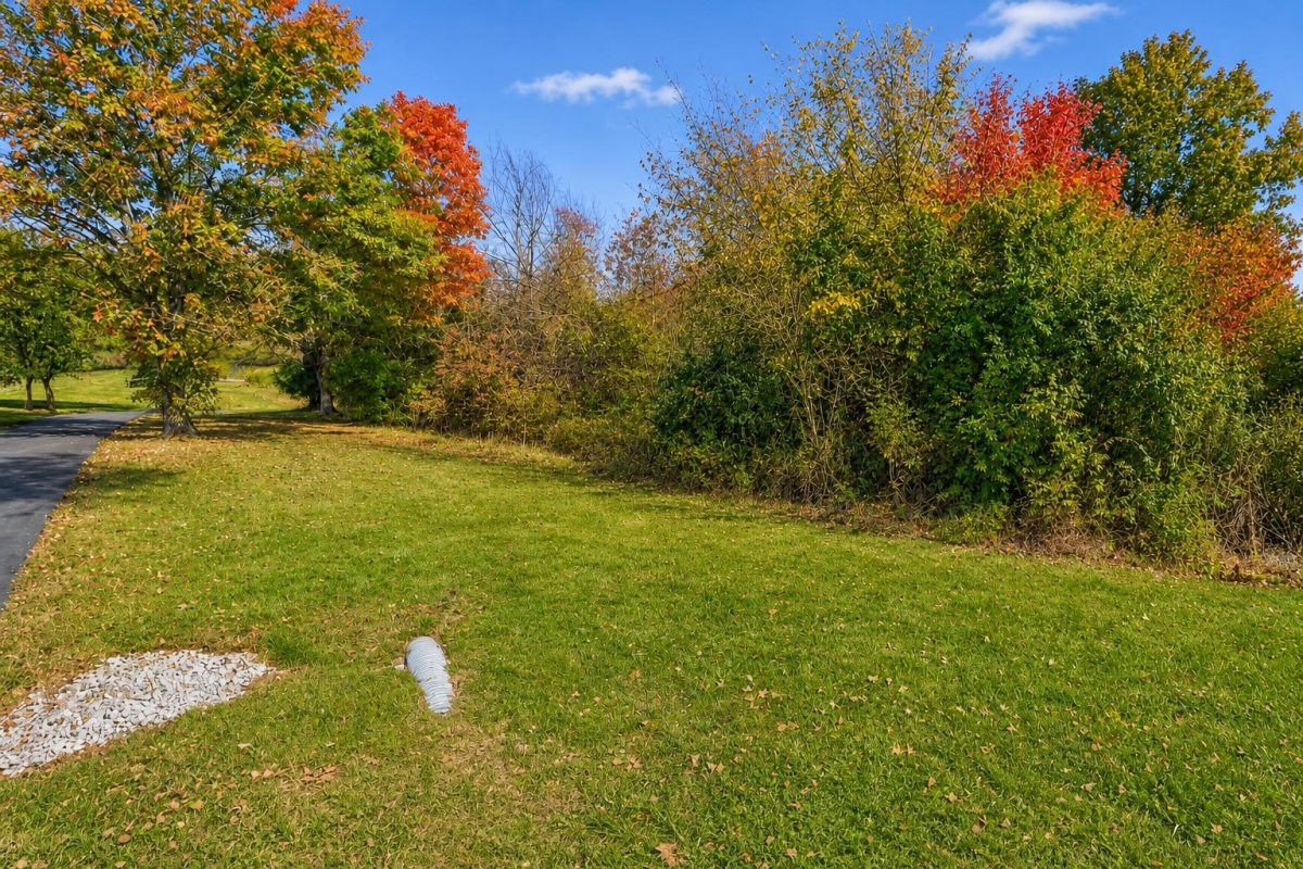
If you’re looking for a small rural parcel in Jefferson County with room to evaluate a home site, mobile-home plan, or recreational base, this listing puts the essential questions front and center: zoning, access, water, septic, and county records.
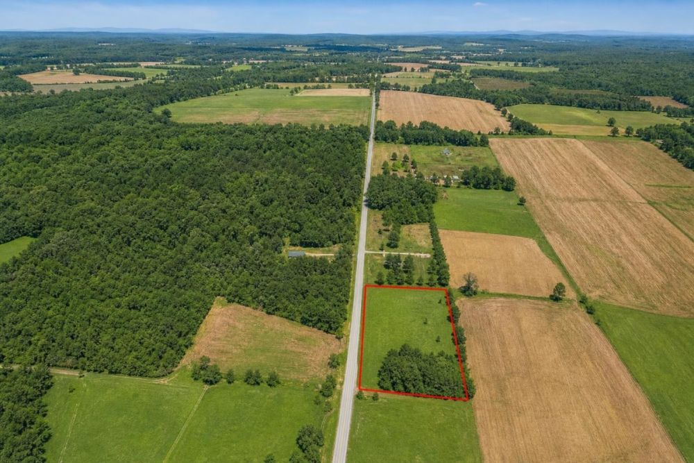
LC26572 is a 3.41-acre vacant land parcel on Leetown Rd in Kearneysville, West Virginia 25430. It is listed at $85,000 cash, with parcel number 19-07- 14-0006.0003 and legal description Lt #1 Clendening-owens.
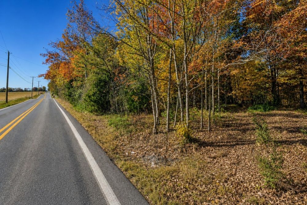
The supplied data lists Rural (R) zoning, paved road access, and well and septic needed. Those are useful starting points, not final approvals; buyers should confirm zoning, legal access, flood status, utilities, and septic feasibility with Jefferson County and the appropriate local authorities.
Property snapshot
LC26572 is seller-listed vacant land tied to parcel 19-07- 14-0006.0003. The database also lists a Warranty deed and legal description Lt #1 Clendening-owens; verify deed, title, and acreage through closing and county records.
Use this when asking LandCentury or the seller about this exact listing.
This is the best starting point for Jefferson County assessor, GIS, zoning, tax, and title research.
Sets the scale for setbacks, septic area, driveway planning, and any clearing or site work.
Use this as the listed purchase price when comparing total project costs, not just land cost.
A useful clue for potential use, but the county must confirm current zoning and allowed uses.
This suggests road access in the listing, but legal access, driveway permits, and maintenance status still need confirmation.
Budget time and money for well and septic feasibility rather than assuming public water or sewer.
Treat this as a carrying-cost reference and confirm the current bill with Jefferson County.
Leetown Rd and Jefferson County setting
Kearneysville is in Jefferson County in West Virginia’s Eastern Panhandle, where rural parcels are often evaluated through county GIS, zoning, health department, and floodplain resources before a buyer commits to a home or recreational plan.
For this specific listing, the parcel is identified on Leetown Rd with coordinates 39.336247, -77.948952. Those coordinates are useful for map checks, but they do not replace a boundary survey or title work.
The area context should be read separately from parcel approvals: county-wide rural character does not automatically mean a dwelling, mobile home, RV stay, driveway, well, or septic system will be approved on this lot.
Potential buyer fit and uses
This parcel best fits a buyer who wants a small rural landholding and is prepared to verify the development path before designing improvements. The acreage and listed Rural (R) zoning may make it worth evaluating for residential, mobile-home, recreational, or hold-for-future-use scenarios, but none of those uses should be treated as preapproved.
The make-or-break items are practical ones: current zoning, setbacks, frontage, legal access, driveway approval, water, septic, floodplain status, title restrictions, and utility-extension costs.
- Rural homesite evaluation, subject to zoning rules, setbacks, frontage, driveway approval, flood review, septic approval, and well feasibility.
- Manufactured or mobile home evaluation, only if county zoning, building rules, foundation requirements, utility approvals, and any recorded restrictions allow it.
- RV or camping use on a limited or recreational basis, only if local rules and private restrictions permit the duration and type of occupancy.
- Low-intensity recreation or small landholding, subject to safety rules, neighbor impacts, access, and any conservation or easement limits.
- Long-term hold while the buyer confirms title, taxes, boundaries, and development costs.
Due diligence checklist before making an offer
Start with the parcel number, then work outward from official records to physical site conditions. The goal is to verify whether the land supports your intended use before you commit nonrefundable money.
Pull the county parcel record
Search parcel number 19-07- 14-0006.0003 and compare the mapped location, acreage context, legal description, and assessor details with the listing. GIS is not a survey, but it can reveal mismatches worth investigating.
Confirm zoning and allowed uses
Ask Jefferson County planning or zoning staff to verify the current Rural (R) designation, permitted residential uses, mobile-home rules, RV rules, setbacks, frontage requirements, subdivision history, and any overlays.
Verify legal access and driveway requirements
The listing says Paved Road. Confirm whether the parcel has legal frontage or an easement, whether the road is publicly maintained, and what driveway or entrance permits would be required.
Investigate well and septic feasibility
Because the listing says well and septic are needed, contact the appropriate local health or permitting authority about soil testing, perc requirements, reserve areas, well setbacks, septic setbacks, and likely approval steps.
Check floodplain, drainage, and site constraints
Use official floodplain resources for the exact parcel location and review drainage, slope, wetlands, stream proximity, and any low-lying areas. The supplied listing data does not establish flood status.
Review title, deed, and recorded restrictions
A Warranty deed is listed, but buyers should still review the title chain, deed language, easements, covenants, mineral or access rights, and any HOA or POA restrictions if they exist.
Confirm taxes and carrying costs
Verify whether the listed $1,081.00 tax figure is current, whether reassessment could occur after sale, and whether any additional assessments or association costs apply.
Price the full development budget
Estimate survey, clearing, driveway work, engineering, well drilling, septic installation, power extension, internet options, permits, closing costs, and ongoing maintenance before judging affordability.
The selected official source is the Jefferson County WV Parcel Viewer because it is the county parcel and GIS entry point most directly tied to this property. Use it to compare the parcel number, mapped position, and assessor context before ordering a survey or asking county offices about zoning and permits.
Price and financing notes
The supplied pricing shows a $85,000 cash price for LC26572. No owner-finance price, down payment, or payment terms are listed in the property data.
If you plan to use a land loan or other financing, ask the lender early about vacant-land requirements, appraisal needs, title conditions, and whether well/septic uncertainty affects approval.
Do not spend heavily on design or inspections until you know the seller’s accepted payment path, closing timeline, and refund rules for any deposit.
- Is the seller accepting only a cash closing, or will another financing path be considered?
- What due-diligence period is available before funds become nonrefundable?
- Will the lender require a survey, zoning confirmation, title commitment, or septic documentation?
How to compare this parcel against other land
Do not compare rural parcels by acreage and asking price alone. For this lot, compare confirmed use, legal access, septic feasibility, well potential, flood status, restrictions, and utility-extension costs.
A parcel with a lower asking price can be more expensive to use if it lacks access or septic options; a higher-priced parcel may be more practical if key approvals are already documented. Require written verification before treating any comparison as apples-to-apples.
Questions buyers may ask about this property and area
Bottom line for LC26572
LC26572 is a straightforward small-acreage land listing: 3.41 acres on Leetown Rd in Kearneysville, Jefferson County, with a $85,000 cash price, Rural (R) zoning listed, paved road access listed, and well/septic needs disclosed.
The upside is the clarity of the basic land facts. The open questions are the ones that decide real usability: current zoning, permitted use, septic feasibility, legal access, flood status, title, restrictions, and the full cost of creating a buildable or usable site.
If your plan depends on a home, mobile home, RV setup, or regular recreation, treat the listing as the beginning of due diligence rather than the end. Pull the county record, call the relevant offices, and price the site work before moving forward.
Ready to look closer?
Review the complete listing details, photos, and seller information, then use the parcel number to begin county verification.
Official verification resource
Start with the Jefferson County WV Parcel Viewer to compare the parcel number, mapped location, and assessor/GIS context before ordering a survey or asking county offices about zoning and permits.

You Might Like

Waterfront Land for Sale - Top Designations and Uses
Waterfront land is extremely valuable. There are two types of land that youll find with waterfront views: oceanfront land and lakefront land. While there are many types of waterfront options,...
Helena-West Helena, AR Land for Sale: 0.31 Acres with Paved Access & City Utilities
A low-cost Renee Street residential lot with city utilities noted—plus the checks buyers should make first.

7 Key Things to Look For When Buying Residential Land
Whether you're buying residential land to build your dream home or for investment purposes, its important to know what to look for when searching for vacant land. Buying land is...