San Luis, CO Land for Sale: 10 Acres with Owner Financing Available
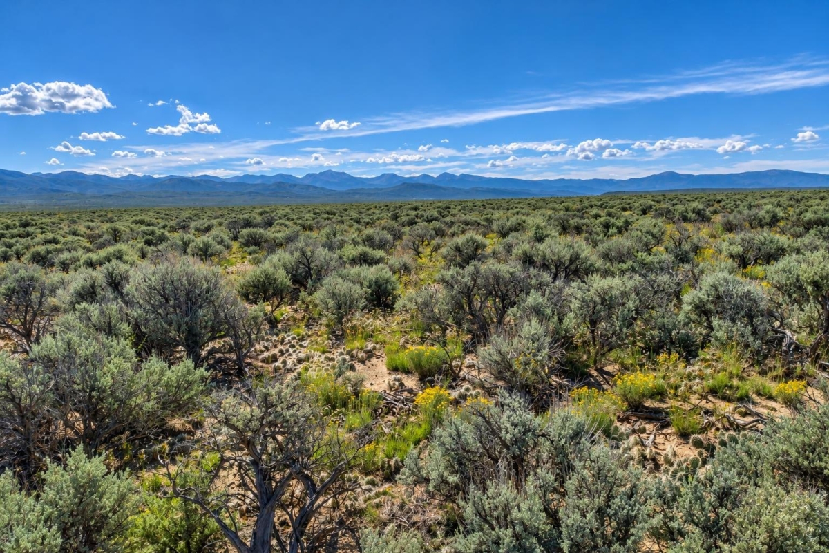
If you want meaningful acreage in the San Luis Valley and prefer a purchase structure that does not require paying the full amount upfront, this Costilla County land listing is worth a closer look. The appeal is straightforward: 10 acres, a stated cash price, listed owner-finance terms, and a parcel number buyers can use for official research.
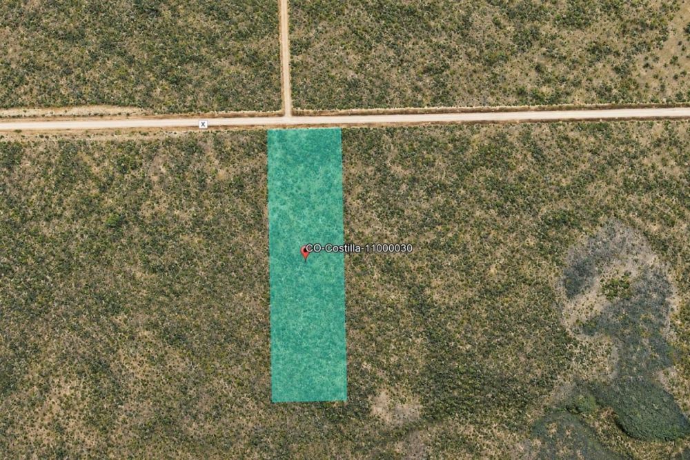
The offering is LandCentury property LC27128, identified as parcel number 11000030, in San Luis, Colorado 81152. The supplied location reference is US HWY-160, RT-159, with coordinates of 37.288844, -105.459164. The cash price is listed at $18,439, and the owner-finance terms are listed as $499 down and $295 per month for 80 months.
The main caveat is equally important: the supplied data lists Residential zoning and Dirt Road access, but it does not verify utilities, water, septic, legal access details, flood status, or permit approval. Treat those items as due-diligence questions, not assumptions.
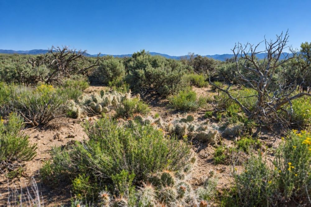
Property snapshot for parcel 11000030
This snapshot separates the verified listing data from the questions a buyer should still confirm. For rural land, the parcel number, access description, zoning label, and utility status are not just details; they shape what the land may realistically be used for and what it could cost to improve.
Use this number when asking LandCentury or the seller about the listing, photos, terms, and current availability.
This is the key identifier for assessor, GIS, tax, title, and county-record research. It helps avoid confusion with nearby parcels or road references.
The size gives a buyer room to plan, but usable area still depends on boundaries, setbacks, topography, access, and any site constraints.
This is the listing's location reference, not a guarantee of highway frontage or approved driveway access. Confirm the exact parcel location with county GIS and maps.
Coordinates are useful for map review, flood-map research, and preliminary site checks before visiting or ordering professional due diligence.
The financing option may reduce the initial cash needed, but the written contract should confirm total cost, fees, deed timing, default rules, and any prepayment terms.
Residential zoning in the listing is a starting point only. County rules control allowed uses, setbacks, permits, RV rules, manufactured-home rules, and whether a residence can be approved.
Dirt road access and low listed taxes are useful clues, but buyers should confirm legal access, maintenance, passability, current tax status, and the availability or cost of utilities.
San Luis and Costilla County setting
San Luis is a historic community in Costilla County in south-central Colorado, near the New Mexico border. For buyers, the practical significance is that this is a rural land market where road access, water, septic feasibility, power availability, and county land-use rules matter more than a simple acreage number.
The supplied property data places the parcel in San Luis, Colorado 81152 and references US HWY-160 and RT-159. That location reference is useful for orientation, but it should not be read as proof of frontage, driveway approval, or direct highway access. If highway access or a driveway connection is part of your plan, confirm the exact parcel relationship to the road system and ask whether county or state transportation approvals are involved.
Costilla County land can appeal to buyers looking for space, privacy, and a lower-density setting, but rural land also shifts more responsibility to the buyer. You may need to confirm whether roads are public or private, whether they are maintained year-round, whether a standard vehicle can reach the parcel in bad weather, and what it would cost to bring in any needed services.
General area context should also be separated from parcel-specific facts. San Luis has historic significance and regional identity, but that does not determine whether this exact 10-acre parcel can support a dwelling, RV use, well, septic system, or driveway. Those answers come from official records, site conditions, and permitting review.
Potential uses and buyer fit
This property is best viewed as rural vacant land with several possible paths, not as a finished homesite. The 10-acre size gives a buyer flexibility, and the listing's Residential zoning label points toward residential intent, but actual use depends on Costilla County zoning, setbacks, permits, access, water, septic, utilities, and any restrictions that apply to parcel 11000030.
The listing categories include mobile home and RV land, but that should not be treated as automatic approval for either use. Many counties distinguish between temporary RV occupancy, storage, camping, manufactured homes, modular homes, and site-built homes. Time limits, permit requirements, foundation requirements, sanitation rules, and occupancy rules can vary. Confirm before buying if an RV, camper, manufactured home, or off-grid setup is part of your plan.
Because utilities are not specified, buyers should budget time for utility research before committing to a building plan. A parcel can be attractive on price and acreage while still requiring a well, hauled water, septic design, power extension, solar system, driveway work, or other infrastructure. Those costs can be more important than the purchase price for buyers planning to occupy or improve the land.
- Future residential site, only if county zoning, access, water, septic, driveway, and building permits can be confirmed.
- Manufactured-home or mobile-home plan, only if the county allows that dwelling type on this parcel and all installation, foundation, sanitation, and occupancy rules can be met.
- RV or occasional recreational use, only if local rules allow the intended duration and use, and only after confirming legal access, waste disposal, water, and fire restrictions.
- Long-term land hold for a buyer who wants acreage in Costilla County and is comfortable carrying taxes and responsibilities without assuming near-term development approval.
- Personal open-space or low-intensity rural use, subject to county rules, road access, environmental constraints, and any recorded restrictions.
- Off-grid planning candidate for a buyer willing to research solar, water, septic, road, and communications options before relying on the parcel for occupancy.
Due diligence checklist before buying
The right way to evaluate this property is to start with the verified listing facts, then pressure-test the unknowns. Use parcel number 11000030 in every official inquiry so county staff, map systems, title professionals, and utility providers are looking at the same land.
Confirm zoning and allowed uses with Costilla County
Ask the planning or zoning office to confirm the current zoning for parcel 11000030, whether it is inside town limits or unincorporated county territory, and what uses are allowed. Specifically ask about site-built homes, manufactured homes, mobile homes, RV occupancy, camping, accessory structures, setbacks, minimum dwelling standards, and permit sequence.
Verify legal access and road maintenance
The listing says Dirt Road access, but buyers should verify whether access is by public road, private road, recorded easement, or another arrangement. Ask who maintains the road, whether it is passable year-round, whether snow or weather can limit access, and whether a driveway permit or approach approval is needed.
Use the parcel number for assessor and GIS research
Look up parcel 11000030 in county assessor or GIS records to confirm ownership, assessed value, current tax status, parcel boundaries, and any available map layers. The listed annual taxes are $106.75, but current taxes, delinquencies, special assessments, and changes should be independently confirmed.
Research water, septic, power, and communications
Utilities are not specified in the supplied property data. Confirm whether power is nearby, whether a well is allowed or practical, whether hauled water is an option, what septic permits require, and what internet or phone service is realistically available. Get cost estimates before assuming the land can support your intended use.
Check flood, drainage, and site conditions
Use the coordinates or parcel reference to review official flood information, then compare that with county GIS and site observations. Also look for washes, drainage paths, low areas, erosion, wetlands, slope issues, wildfire exposure, or other environmental factors that could affect driveways, septic placement, or building locations.
Review title, deed, and seller authority
Before sending significant funds, confirm that the seller has authority to sell the parcel and that the title can be conveyed as promised. Ask about liens, unpaid taxes, easements, mineral reservations, access rights, and the deed process. A title company, attorney, or escrow arrangement can add protection.
Read the owner-finance agreement carefully
The listing states $499 down and $295 per month for 80 months. The written contract should answer whether there are servicing fees, late fees, prepayment penalties, balloon payments, default and cure periods, tax responsibilities, insurance requirements, and when the deed transfers.
Visit the parcel or hire local eyes
If possible, inspect the land before buying. A site visit can reveal road condition, nearby development, terrain, vegetation, drainage, fencing, evidence of use, and whether the map location matches the physical parcel. If you cannot visit, consider hiring a local professional for photos, access verification, or a survey review.
For one official external starting point, use FEMA's Flood Map Service Center to review flood-hazard information for the parcel location or coordinates. Flood maps do not replace a survey, engineering review, or county permitting process, but they are a high-priority screen for vacant land buyers.
How the listed owner financing changes the purchase review
The listing provides two payment paths: a cash price of $18,439 and owner-finance terms of $499 down and $295 per month for 80 months. For buyers who do not want to pay the full cash price immediately, that monthly structure may make the property easier to consider, but it also adds contract details that matter.
Owner financing is not the same as a simple cash closing. The agreement should explain whether the buyer receives the deed at closing or after payoff, who pays taxes during the term, whether late fees or default rules apply, and whether there are any fees not obvious from the listing summary. Ask for the complete written terms before treating the payment amount as the full picture.
Financing should not cause a buyer to skip land due diligence. If the parcel does not support the buyer's intended use, a low down payment does not solve the core problem. Verify access, zoning, utilities, water, septic, title, and flood status before relying on the land for a home, RV setup, or long-term plan.
- Is the stated $499 down payment the full upfront amount, or are there separate documentation, servicing, recording, or processing fees?
- When does the deed transfer to the buyer: at signing, after payoff, or at another milestone?
- Are there late fees, default clauses, cure periods, or repossession terms?
- Is there any balloon payment, interest charge, prepayment penalty, or required escrow arrangement?
- Who pays property taxes during the financing term, and how are tax bills handled?
- Will the seller allow the buyer to use a title company, attorney, or escrow process?
How to compare this parcel with other Colorado land
When comparing this 10-acre San Luis parcel with other Colorado land, do not compare acreage and price alone. Two rural parcels of the same size can have very different practical value depending on recorded access, road condition, zoning, water options, septic feasibility, power distance, flood status, and whether the title is clean.
This property's strongest comparison points are its 10-acre size, stated cash price, owner-finance option, parcel number, listed Residential zoning, and Dirt Road access. The open questions are utilities, water, septic, flood status, exact legal access, and current county records. A strong alternative property should be measured against the same checklist.
For buyers focused on affordability, compare the cash path and the financed path separately. A property with a lower monthly payment may not be the better choice if improvement costs are higher, access is weaker, or the intended use is not permitted. Build the comparison around the full cost to make the land usable for your plan.
Questions buyers may ask about this property and area
Bottom line for buyers
This 10-acre San Luis parcel has the ingredients many rural land buyers look for: a defined parcel number, a stated cash price, an owner-finance option, a Costilla County location, and listed Residential zoning. For a buyer who wants acreage and is comfortable doing the work, it is a property worth evaluating carefully.
The unresolved items are the ones that matter most for real-world use. Utilities are not specified, buildability is not verified, the access description should be confirmed, and flood status is not provided. If your plan depends on living on the land, placing an RV, installing a manufactured home, or building a residence, get written answers before committing funds.
The best next step is not to assume; it is to verify. Use parcel number 11000030, review county records, ask direct zoning and access questions, check FEMA flood information, and request the complete financing documents if you are considering the payment plan.
If this parcel feels promising but you are still shaping a budget, compare it with cheap homesteads for sale and other affordable land options so you can weigh acreage, access, utilities, and financing terms side by side.
Ready to examine parcel 11000030?
Review the full listing details, photos, and seller information, then use this guide as a checklist before making a decision.
Useful buyer resources
Use the parcel number with Costilla County assessor or GIS records, the county planning or zoning office, utility providers, title professionals, and FEMA flood maps before closing.


You Might Like

What are Real Estate Investment Trusts and How Do They Work?
Curious to find out what real estate investment trusts are and how they function? See a full break-down or REITs and their advantages and features inside.

Ensuring Conveying of All Rights and Interests When Buying a Property
When you go to buy a piece of property, youll do so with the intent of actually owning the land after the purchase has occurred. A major issue is that...

How to Yield Big Returns by Investing In Land
Most people invest in land under the assumption that theyll see a steady, long-term return. But if you know how to play your cards, you can see big returns. Theres...