Springfield, AR Land for Sale: 12.95 Acres on Bethlehem Rd with Owner Financing
Some rural land listings are easy to understand at a glance. Others need a little more real research before a buyer can decide whether the property fits a cabin plan, a future homesite, or simply recreational use. This 12.95-acre tract in Springfield, Arkansas falls into that second category in a good way: the parcel identity and financing are clear, but access, utilities, and buildability still need to be confirmed the right way.
This property is a vacant land listing in Conway County: on Bethlehem Rd, identified as parcel 001-03251-004: and property ID LC25291:. The listed cash price is $75,000:, and the seller also advertises owner financing at $30,000 down:, $1,205.01 per month for 48 months:, plus a $35 monthly servicing fee: at 12.9% interest:. The main buyer caution is simple: the listing says road access must be verified with the county and utilities are not confirmed.
If you are comparing this exact Land Century listing with other rural parcels, treat it as a tract with a strong paper trail on parcel identity and deed type, but with several practical site questions still open. That is not unusual for vacant land for sale in rural areas, but it does mean your next step should be verification, not assumption.
Property snapshot
- Property number: LC25291
- Property type: Vacant land
- Categories: Recreational & Hunting Land, Vacant Land, Owner Finance Deal
- Location: Bethlehem Rd, Springfield, Conway County, Arkansas 72157
- Coordinates: 35.2880, -92.5959
- Lot size: 12.95 acres
- Parcel/APN: 001-03251-004
- Legal description: Tract 5 in Section 33, Township 8 North, Range 15 West, Conway County, Arkansas
- Deed type: Warranty Deed
- Cash price: $75,000
- Owner financing: $30,000 down, $1,205.01/month for 48 months
- Extra finance cost noted: $35/month servicing fee and 12.9% interest
- Zoning: No Zoning: listed; verify locally
- Road access: Verify with the county
- Utilities: Unconfirmed in the listing; county contact suggested
- Reported taxes: 16.83 listed, but the unit or period is not specified
- Seller context: By-owner listing from Luke Harris
Those facts make this parcel specific and searchable, which matters. On rural land, the parcel number, legal description, and county location often tell you more than marketing language does.
Location context
The listing places the tract in Springfield, Arkansas, within Conway County. For most buyers, county-level research will matter more than a city-style lot analysis. That is especially true here because the listing states No Zoning:, which may sound simple but does not automatically answer whether you can build, place a manufactured home, install septic, or get utility service without added requirements.
For buyers browsing Arkansas land for sale, this is the kind of parcel that may appeal to someone looking for more space than a small residential lot, possibly for recreation, rural use, or a future project. But acreage alone does not answer the important questions. You still need to confirm whether Bethlehem Rd provides legal and practical access, whether the terrain works for your intended use, and whether the county records line up with the listing data.
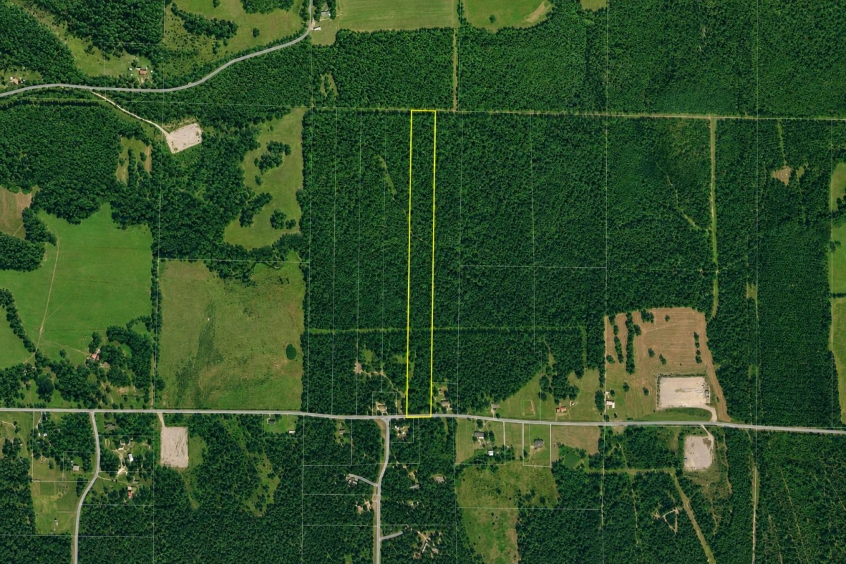
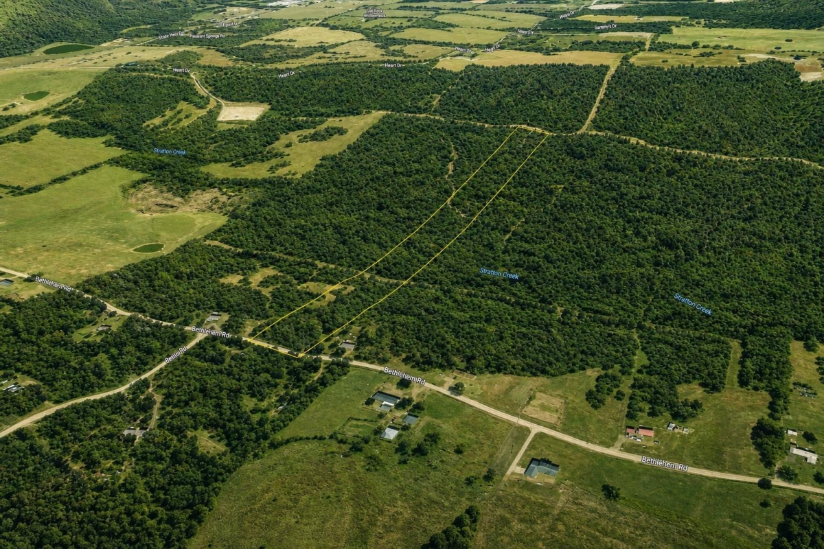
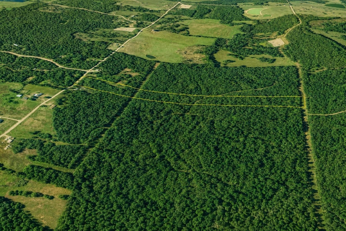
The listing package includes map and terrain-style images, including flood and elevation references, which are useful starting points. Still, state GIS parcel outlines are commonly approximate rather than legal boundary proof, so rely on the deed, survey information if available, and county records before treating any mapped line as final.
What the facts mean for a buyer
The strongest confirmed points here are the acreage, price, parcel identity, legal description, deed type, and financing terms. The less certain points are the ones that affect use the most: access, utilities, flood exposure, septic feasibility, and whether any restrictions apply beyond the seller's short zoning note.
- No zoning listed: This usually means a buyer should ask deeper questions, not fewer ones. Deed restrictions, floodplain rules, easements, setback rules, and county development standards can still matter.
- Road access: not confirmed: If you cannot verify legal access, the parcel may be harder to use, finance, improve, or resell.
- Utilities: not confirmed: Do not assume power, water, sewer, or internet are nearby just because a road name is provided.
- Taxes: unclear: The listing shows 16.83, but it does not say whether that is annual tax, monthly amount, or another figure. Confirm directly with county records.
- Warranty deed: That is a positive listing detail, but buyers should still run title and review easements and rights-of-way mentioned in the legal description.
If you are mainly comparing this tract against other vacant land for sale, the right comparison is not just price per acre. Compare how much is already verified versus how much work you will need to do before closing.
Due diligence checklist
- Confirm parcel identity: Match parcel 001-03251-004 to the legal description, map location, and seller paperwork.
- Verify legal access: Ask whether Bethlehem Rd frontage is public road frontage, private road access, or easement-based access. Get written confirmation when possible.
- Review flood risk: Check the parcel location with the official FEMA Flood Map Service Center rather than relying only on listing graphics.
- Check utilities: Verify power availability, water source options, septic suitability, and internet service before planning any build.
- Ask about survey work: The legal description is detailed, but buyers should ask whether a recent survey exists and whether corners are marked in the field.
- Review title and easements: The legal description says the tract is subject to rights-of-way, covenants, easements, and restrictions of record or physically in place. That language should be reviewed carefully during title work.
- Confirm taxes and status: Verify what the listed 16.83 figure means and whether taxes are current.
- Check intended use: If you want to build, confirm driveway requirements, setbacks, septic approval, and any county or service-area rules that apply.
- Map the coordinates: Use 35.2880, -92.5959 as a field-check starting point, but do not treat coordinates alone as a boundary survey.
- Review financing cost: Owner financing can be useful, but compare the down payment, rate, servicing fee, and 48-month payoff schedule against your cash and borrowing options.
Questions buyers may ask about this property and area
What is the parcel number for this Springfield, Arkansas land listing?
It is parcel 001-03251-004:. Use that number to match county records, title work, and mapping references.
How many acres are being sold?
The listing states 12.95 acres:. The legal description also says “more or less,” so exact boundary confirmation should come from survey-level review.
Is owner financing available?
Yes. The listing states $30,000 down:, $1,205.01 per month for 48 months:, plus a $35 monthly servicing fee: at 12.9% interest:.
Can this 12.95-acre tract be built on?
That is not confirmed: by the listing. Verify access, septic feasibility, floodplain status, setbacks, and any county or deed-based restrictions before assuming buildability.
What does “No Zoning” mean here?
It is a listing statement, not a full legal use opinion. A parcel can still be affected by easements, restrictions, floodplain rules, and county development requirements.
Is road access confirmed?
No. The listing says verify with the county:. This should be one of the first questions you solve before moving forward.
Are utilities confirmed?
No. The listing tells buyers to contact the county. You should independently verify power, water, septic, and internet options.
Where do I check flood risk?
Use FEMA's official flood mapping tools. That is the best source for checking mapped flood hazards tied to the parcel location.
Where should I verify taxes and parcel records?
Start with Conway County: records using the parcel number and legal description. Confirm ownership, assessed value, and what the listed tax figure actually represents.
Why does owner financing matter on land like this?
It can widen your buying options, but the total cost depends on the down payment, interest rate, servicing fee, and payoff term. Compare it carefully with cash or other financing.
Next steps
This tract may fit a buyer who wants a larger rural parcel in Conway County: and is comfortable doing real due diligence before closing. The acreage and financing are straightforward. The practical use questions are not, at least not yet.
Before you commit, pull together the parcel records, flood review, access answer, and utility/septic research in one file. Then compare this parcel with other owner finance land deals to see whether the price and risk balance works for your plans.
What is the most important thing to verify about this parcel first?
Legal access and parcel identity Then flood risk and utilities Then county records and title
Where do I check whether the land is in a flood zone?
FEMA Flood Map Service Center Use the parcel location and coordinates Check both maps and any available flood studies or revisions
What does 'No Zoning' mean for this property?
It is a listing statement, not a legal conclusion County: restrictions, deed restrictions, and floodplain rules can still apply Confirm with the appropriate local office
Is owner financing available for this listing?
Yes Down payment is $30,000 Monthly payment is $1,205.01 for 48 months with a $35 servicing fee and 12.9% interest
What are the owner-finance terms?
$30,000 down $1,205.01/month 48 months
Where can a buyer verify Conway County: parcel and tax information?
Conway County: Assessor is the starting point Use parcel number 001-03251-004 and legal description Confirm assessed value and tax status directly
Useful buyer links

You Might Like

Finding Cheap Homes with Acreage for Sale
When youre trying to find a home that's on a large lot, youll find that the process is little more difficult than finding a regular home. Acreage is in high...

Is Los Lunas, New Mexico a Smart Place to Buy Land?
Nicknamed The Moon, Los Lunas is a village in Valencia County, New Mexico. Although the term village often brings to mind images of small towns, Los Lunas boasts a growing...

The Land Buying Guide: Jacksonville, Florida
Florida is known for beautiful weather and even more beautiful water. The state itself is filled with activities for people to enjoy from going to the beach to visiting Disney...