Jordan Valley, OR Land for Sale: 20 Acres with Owner Financing, Parcel 11900
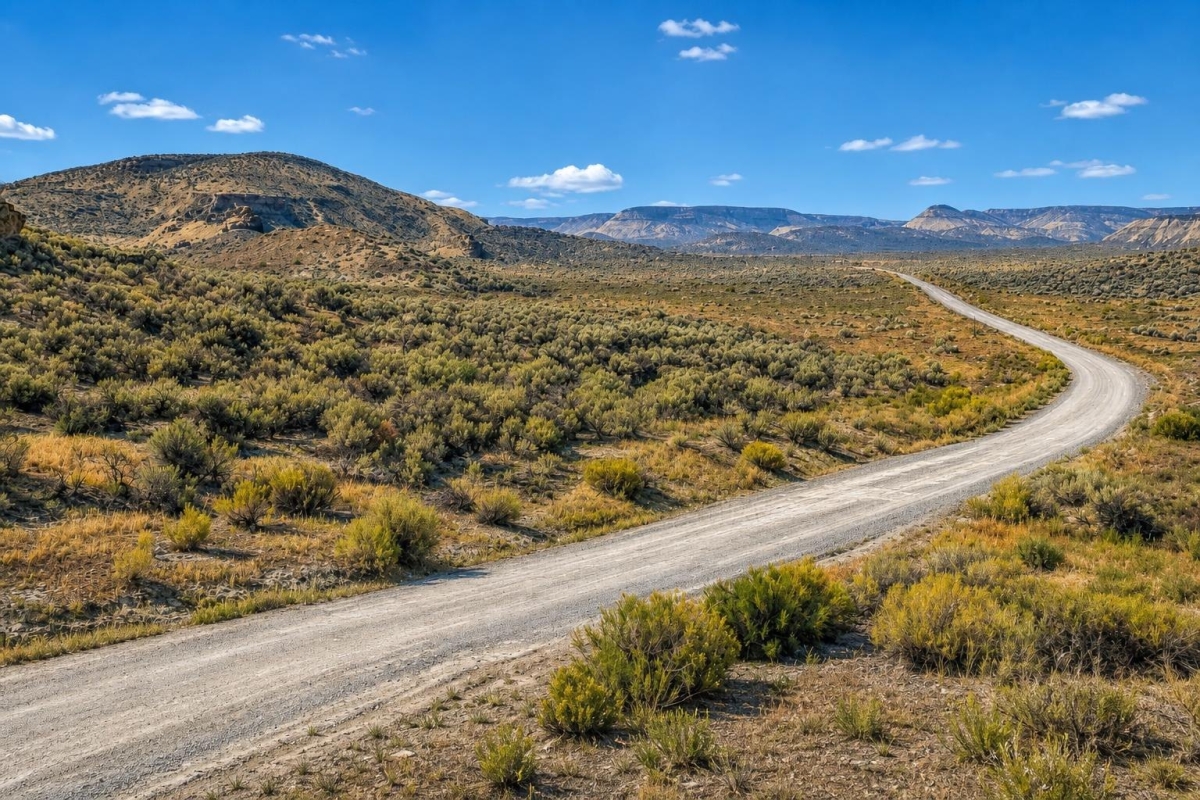
If you are shopping for low-cost rural acreage in eastern Oregon, this parcel is worth a close look—but it is not a buy-it-blind homesite. The important questions here are access, zoning, water, septic, and whether the land can support your intended use after county review.
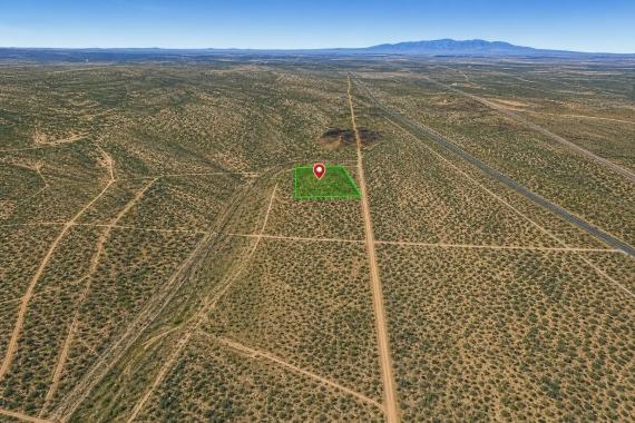
The property is a 20-acre vacant land parcel in Malheur County near Jordan Valley, Oregon 97910, in the Kiger Rd vicinity. The listing identifies parcel number 11900, LandCentury property number LC26186, and a cash price of $13,900, with owner financing advertised at a $20,000 price.
The key caveat is significant: the supplied listing data says “No Access,” with well and septic needed. The listed zoning is C-a2, which county zoning context identifies as Exclusive Range Use, so buyers should verify legal access and permitted uses before treating the parcel as buildable.
Property snapshot: what the listing data confirms
These are the core facts a buyer should use when checking county records, maps, and title documents. Several items are buyer-verification points rather than guarantees of use.
Use these identifiers when comparing the listing to assessor, GIS, tax, and title records.
This places the parcel in a rural southeastern Oregon setting where infrastructure and services should be verified parcel by parcel.
The acreage gives room for rural land uses, but size does not solve access, zoning, water, or septic questions.
Cash and financed pricing differ, so buyers should compare total cost and contract terms before choosing a payment path.
Malheur County zoning context identifies C-a2 as Exclusive Range Use; confirm the exact permitted uses with county planning.
This is a major due-diligence item. Legal and physical access should be confirmed in recorded documents before closing.
The listing does not confirm installed water or septic service. Feasibility and cost can materially affect the purchase decision.
Low reported taxes are attractive, but the current tax bill, assessments, and delinquency status should be verified with the county.
Area setting: rural Malheur County context
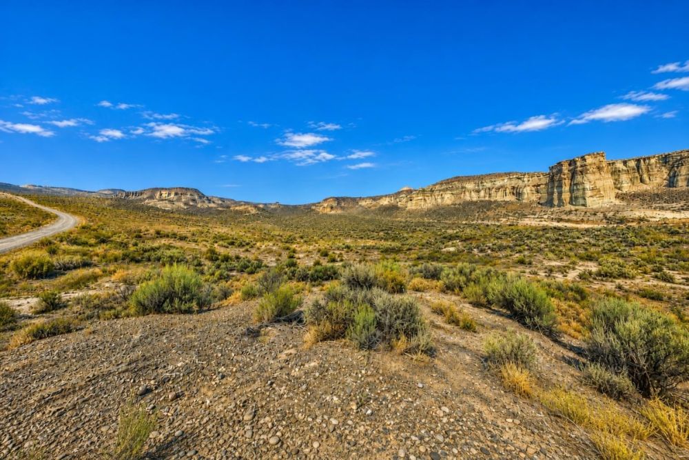
Jordan Valley sits in far southeastern Oregon, where land buyers should expect a rural high-desert setting, limited nearby infrastructure, and longer service distances than in suburban markets. That general context matters because development planning often depends on access, water, septic, road conditions, and county approvals.
The parcel-specific location data places this 20-acre property in the Kiger Rd vicinity near Jordan Valley, with coordinates supplied as 42.843021, -117.733867. Those coordinates are useful for preliminary map review, but they should be matched against county GIS boundaries and title records before a buyer relies on them.
For land-use questions, the relevant local starting point is Malheur County. The county planning function handles zoning and land-use applications, while building-permit questions are handled through the county building department. That sequence matters: first confirm that your use is allowed, then evaluate the structure, utility, and site-permit path.
Potential uses and buyer fit
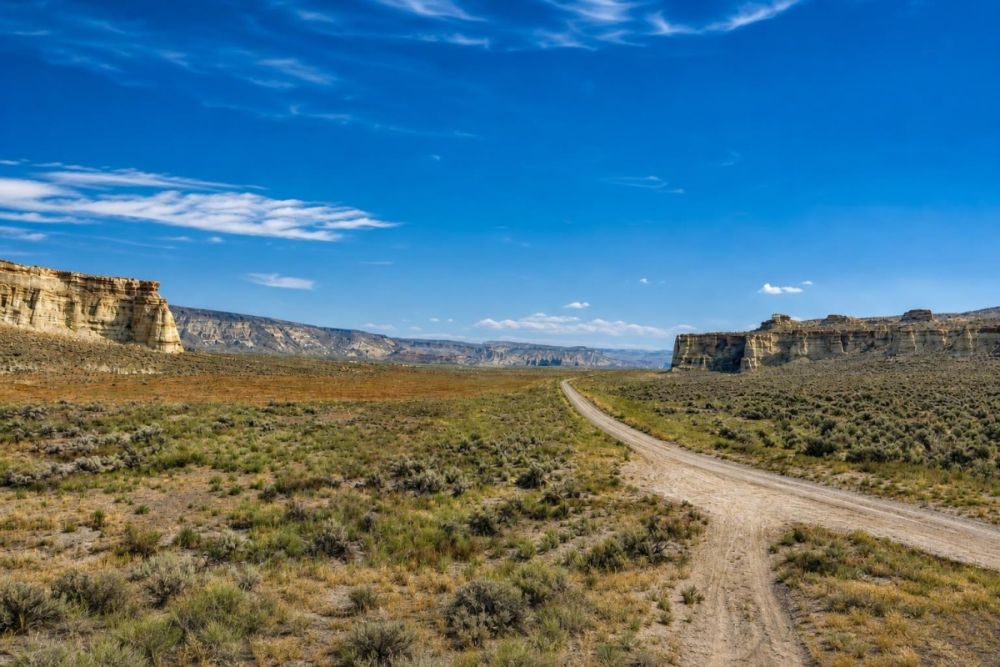
This property is best suited for a buyer who is comfortable doing raw-land due diligence before planning improvements. The 20-acre size may appeal to people seeking rural space, long-term land ownership, or an off-grid concept, but the listing’s no-access status is the first issue to solve.
Potential uses should be treated as possibilities only. Any residence, mobile home, RV use, agricultural/range use, storage, campsite, or other improvement depends on zoning, permits, legal access, utility availability, water, septic approval, recorded restrictions, and any applicable county or environmental rules.
- Rural land holding for a buyer who wants acreage and is prepared to verify title, access, taxes, and zoning before closing.
- Range, agricultural, or low-intensity land concepts only if C-a2 / Exclusive Range Use rules and legal access support the intended activity.
- Off-grid planning after confirming legal ingress, well feasibility, septic feasibility, flood/drainage conditions, and building-permit requirements.
- Future residential, mobile-home, or RV ideas only if Malheur County confirms the use is allowed and the parcel can meet access, water, wastewater, and permit standards.
Due diligence checklist before making this land your plan
Use the parcel number, coordinates, and listing facts as the starting point. The goal is to confirm what is legally possible, physically practical, and financially realistic before closing.
Confirm legal access in recorded documents
The listing states No Access. Ask for deeded access, recorded easements, road agreements, or other legal ingress documentation, and confirm whether you can physically reach the parcel.
Verify C-a2 zoning and allowed uses
Confirm with Malheur County Planning whether C-a2 / Exclusive Range Use allows your intended use, including any residence, mobile home, RV stay, agricultural use, accessory structure, or storage plan.
Ask about the building-permit path
If you want to build, ask county planning and the building department what approvals, setbacks, access standards, floodplain review, and inspections would apply before any permit could be issued.
Research water options before assuming a well
The listing says Well Needed. Check well feasibility, drilling costs, nearby well data where available, water-rights issues if relevant, and whether any water district connection is realistically available.
Confirm septic feasibility
The listing says Septic Needed. A septic system may require soil evaluation, site approval, setbacks, and county or environmental health review before a homesite can be planned.
Check taxes, title, and deed details
Verify the $31.00 tax figure, any delinquency, special assessments, liens, deed type, and legal description through county and title records.
Review flood, drainage, wildfire, and road-weather risk
Use FEMA/NFHL and local floodplain resources, plus aerial imagery and site review, to understand whether drainage, seasonal access, wildfire exposure, or terrain affects the parcel.
Match maps to the actual parcel boundary
Compare county GIS, assessor maps, title documents, and coordinates. If boundaries are unclear or future improvements are planned, consider a survey before relying on approximate map lines.
The most useful official starting point is the Malheur County Planning Department because it connects buyers to zoning, land-use, floodplain, and permit-related guidance for parcels in the county.
Financing notes: cash price versus owner-finance terms
The listing shows a $13,900 cash price and a $20,000 owner-finance price. Owner financing is advertised with a $2,500 down payment and 10% APR, with deed transfer after final payment under a contract-for-deed structure.
The listed monthly options are $371.82 for 60 months, $290.52 for 84 months, or $231.26 for 120 months, based on the stated principal-and-interest terms. A separate $249 processing and origination fee is also listed and is not included in the financed amount or the monthly payment examples.
Before choosing financing, ask for the full contract in writing. Confirm payment schedule, total amount paid, late fees, default language, prepayment rights, payoff process, tax responsibility, and when documents are recorded or transferred.
- What is the total amount paid over the full selected term, including fees?
- Is there any prepayment penalty or discount for early payoff?
- Who is responsible for annual taxes during the contract period?
- What happens if a payment is late or missed?
- When is the deed transferred, and how is the payoff documented?
How to compare this parcel with other Oregon land listings
Do not compare this property by acreage and price alone. For rural Malheur County land, legal access, zoning, water, septic feasibility, and terrain can matter more than the advertised price per acre.
When reviewing other Oregon land for sale, separate improved lots from raw acreage. A smaller parcel with legal road access and confirmed utilities may be more usable than a larger parcel that still needs access, a well, septic approval, and a clear permit path.
For owner-financed land, compare both the cash price and the financed total cost. The lower monthly payment may be helpful, but the contract terms and due-diligence findings should drive the decision.
Questions buyers may ask about this property and area
Bottom line for buyers
This 20-acre Jordan Valley-area parcel offers a low cash price, owner-finance availability, and a clear county lookup trail through parcel number 11900. For a buyer seeking rural Oregon acreage, those are useful starting points.
The limiting facts are just as important: the listing says No Access and indicates that both a well and septic are needed. Combined with C-a2 / Exclusive Range Use zoning context, that means the right buyer is someone who will verify the fundamentals before planning improvements.
If the access and zoning check out for your intended use, the parcel may deserve a deeper look. If legal access cannot be documented or utility feasibility does not pencil out, the low entry price may not be enough to support your plans.
Want to review the listing details?
Open the full property listing to see the seller information, pricing, gallery, and current availability, then use the checklist above before moving forward.
Buyer resources
For next steps, compare similar vacant land and owner-finance opportunities, then confirm zoning, access, taxes, and permit requirements with the appropriate county offices.
You Might Like

What Is The Best Way To Find Land And Acreage Directly From Sellers?
Land and acreage isnt only sold through conventional means. Sales happen every day where land is never advertised by realtors, yet someone managed to get the perfect parcel of land...


The Development Land Challenge - Investors' Vicious Circle
Investors enter into a vicious cycle that we like to call the development land challenge. Several issues will be faced by investors when they are attempting to buy land and...