Mayflower, Arkansas Land for Sale: 0.33 Acres with Paved Road Access
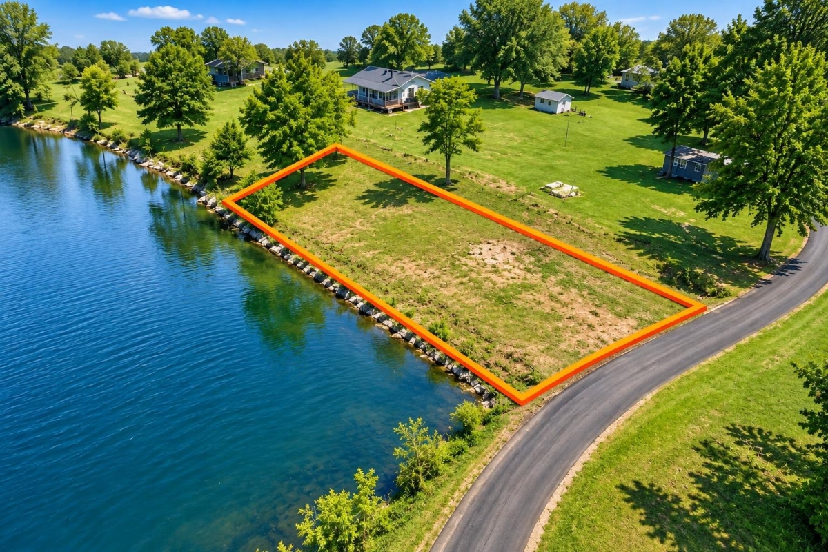
For buyers looking at small, affordable Arkansas lots, the appeal here is a manageable residential-size parcel where the next step is not guesswork, but verification. The key is understanding what the listing facts do and do not prove before making plans for a home, utilities, or resale.
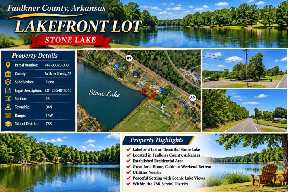
This property is 0.33 acres, or 14,375 square feet, at 10 Satterfield Road in Mayflower, Faulkner County, Arkansas. It is identified as parcel/APN 468-00020-000 and is listed at a $1,399 cash price with a Warranty Deed noted in the property data.
The listing shows Residential zoning, paved road access, and city utilities available. Those are useful starting points, but they are not the same as a building permit, installed utility connections, confirmed legal access, or floodplain clearance. A careful buyer should confirm jurisdiction, zoning standards, utility availability, access, title, taxes, and any restrictions before closing.
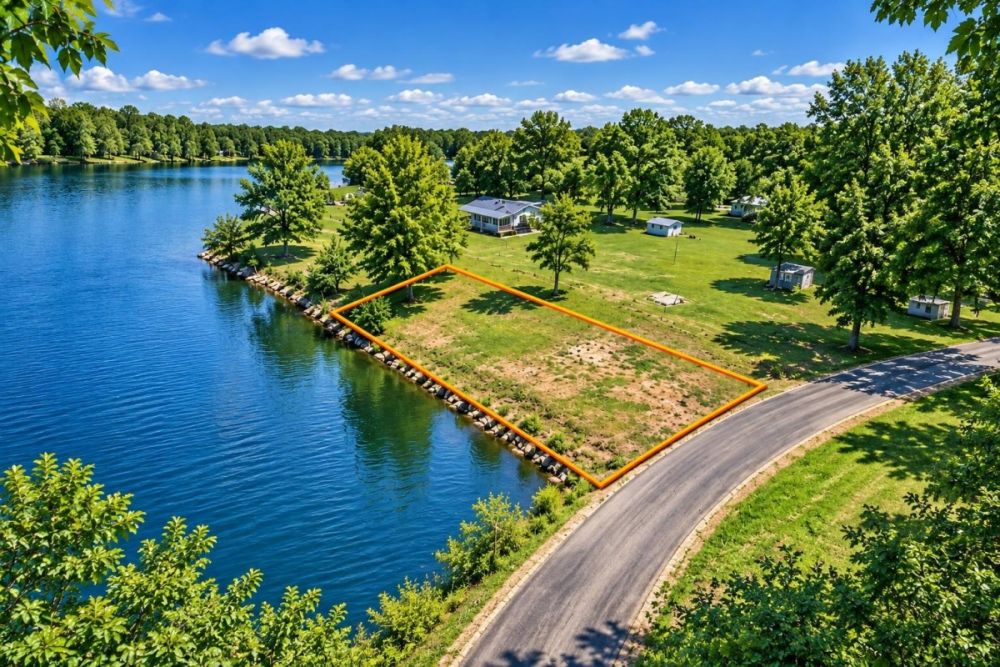
Property Snapshot: What the Listing Data Shows
The most useful way to evaluate this Mayflower parcel is to separate fixed listing facts from items that still need confirmation. The facts below come from the supplied property record and should be used as a starting checklist for county, city, title, and utility research.
Use this address for mapping and local inquiries, but verify whether the parcel is inside city limits because a mailing address or ZIP code may not prove jurisdiction.
The parcel number is the best identifier for assessor records, GIS maps, tax research, floodplain review, and closing due diligence.
This is a small residential-scale lot, so setbacks, easements, drainage, and utility placement can matter as much as the total square footage.
The listing data shows a cash price and does not show owner-finance terms, so buyers should confirm the total amount due and any closing or recording costs.
A warranty deed is the stated form of conveyance, but buyers should still order title review and check for liens, easements, restrictions, and unpaid taxes.
Residential is a helpful listing label, but the exact zoning district, setbacks, minimum lot requirements, and permitted uses need confirmation with the correct local authority.
Paved road access is listed, but buyers should verify legal frontage, public maintenance, driveway permission, culvert needs, and any right-of-way issues.
Availability does not necessarily mean services are connected, taps are paid, sewer is present, or every utility line is at the lot; written confirmation is important.
Mayflower and Faulkner County Setting
Mayflower is a Faulkner County city in central Arkansas. The city describes itself as located between Little Rock and Conway off Interstate 40, which gives useful regional context for buyers comparing central Arkansas land. That general location context should not be confused with parcel-specific conclusions about commute time, services, school assignment, road maintenance, or buildability.
For this parcel, the most important local question is jurisdiction. Mayflower provides city pathways for building and zoning, permits, code enforcement, streets, and water service, and local officials are the right starting point for development questions. The city also notes that a Mayflower mailing address or ZIP code does not automatically mean a property is inside the city limits, so buyers should confirm whether city rules, county rules, or a combination applies.
Faulkner County resources also matter because parcel records, GIS mapping, roads, floodplain resources, fire district information, and 9-1-1 addressing can all affect land decisions. The parcel number, 468-00020-000, should be used whenever possible because it reduces confusion and connects the lot to official records more reliably than informal descriptions.
Potential Uses and Buyer Fit
At roughly one-third of an acre, this is not a broad recreational tract or a large rural homestead parcel. It is better viewed as a compact residential lot candidate where the value of the property depends heavily on the buildable footprint, utility path, access, floodplain status, and local development rules.
The listing’s Residential zoning label and city-utilities wording may make the parcel worth investigating for a future residential project, but buyers should not assume a home, manufactured home, RV use, short-term camping, accessory structure, or utility hookup is allowed until the appropriate city or county office confirms it in writing. On a small lot, a setback line, drainage feature, easement, or utility placement issue can change the practical use of the entire parcel.
- Future residential homesite research, conditioned on zoning district confirmation, permit eligibility, setbacks, floodplain status, utility service, and legal access.
- Hold as a small vacant land parcel in Faulkner County, after confirming taxes, title, restrictions, and ongoing ownership costs.
- Possible fit for a nearby owner or buyer wanting a compact parcel, if boundaries, easements, and intended use are verified by records and survey work.
- Low-entry-price land purchase for a buyer who is comfortable doing city, county, utility, and title due diligence before relying on the property for any specific plan.
- Not an obvious fit for buyers who need acreage, agricultural use, guaranteed RV/camping rights, or immediate construction without first completing local verification.
Due Diligence Checklist Before You Buy
This is the practical checklist a buyer should work through before closing on the Mayflower parcel. Use the parcel number, the street address, and the coordinates together when contacting officials so everyone is looking at the same piece of land.
Verify the parcel in county records
Look up APN 468-00020-000 in Faulkner County property and GIS records. Confirm owner of record, assessed value, parcel dimensions, tax status, legal description, and whether the mapped parcel matches the listing location.
Confirm city limits and exact zoning
Ask whether 10 Satterfield Road is inside the City of Mayflower and confirm the exact zoning district. The listing says Residential, but a buyer needs the actual district rules, permitted uses, setbacks, lot coverage limits, and any variance or plat requirements.
Ask building officials about the real build path
Before planning a home or other structure, ask what permits would be required, whether the lot meets minimum development standards, what inspections apply, and whether any floodplain, driveway, drainage, or utility approvals are needed.
Get utility answers in writing
The listing says city utilities available, but buyers should confirm which services are available at the parcel, which are merely nearby, and what it would cost to connect. Verify water service, sewer versus septic, electric, gas, trash, and internet with the appropriate providers.
Check floodplain and drainage status
Use FEMA tools and Faulkner County floodplain resources to determine whether any part of the parcel is in a special flood hazard area. If floodplain rules apply, ask what permits, elevation requirements, or development limits could affect the lot.
Confirm legal road access
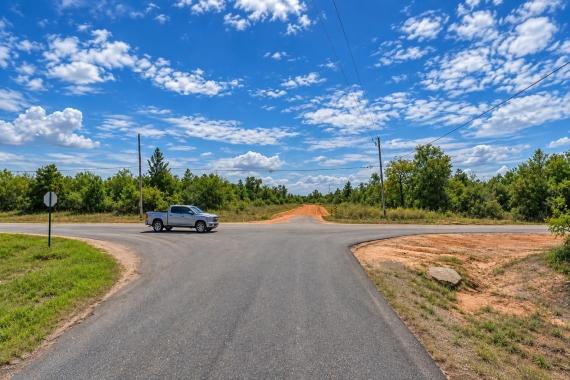
The listing notes paved road access, but legal access should still be verified. Confirm Satterfield Road frontage, public or private maintenance responsibility, driveway or culvert requirements, and any right-of-way or encroachment issues.
Review title, taxes, and restrictions
Order a title search or closing review before paying for the property. Check for liens, easements, deed restrictions, unpaid taxes, special assessments, HOA/POA obligations, or private agreements that could limit use.
Consider a survey or site visit
A survey can be especially valuable on a small lot because boundaries, setbacks, easements, drainage, and neighboring improvements may determine the usable area. A site visit can also help confirm visible access and general site conditions, but it should not replace official records.
For the first local check, the City of Mayflower city map and zoning or street resources are useful because they help buyers begin verifying jurisdiction, zoning context, and street information before following up with city departments for written answers.
Cash Purchase Notes
The listing data shows a $1,399 cash price and does not show an owner-finance price or owner-finance terms. That makes the advertised purchase structure simple, but it does not mean the total cost of ownership is limited to the purchase price.
Before sending funds, budget for normal due-diligence and closing items such as title review, recording, tax verification, survey work if needed, and any attorney or title-company fees. Also ask about utility tap fees, meter fees, driveway or culvert costs, permits, floodplain review, and site preparation before deciding whether the lot fits your budget.
- Is the advertised $1,399 price the full cash price, and what additional closing or recording costs apply?
- Will a title company or attorney handle closing, deed preparation, title search, and recording?
- What are the current taxes, and are any delinquent taxes, liens, or assessments attached to the parcel?
- What utility connection, survey, permit, driveway, or floodplain-review costs could apply after purchase?
How This Lot Compares to Other Land Searches
Compared with larger rural acreage, this property is much smaller and more dependent on local development details. The upside is that the listing notes paved road access and city utilities available; the tradeoff is that setbacks, easements, drainage, and utility placement can quickly determine whether a one-third-acre lot fits a buyer’s plan.
Compared with remote off-grid land, this Mayflower parcel may offer clearer local department pathways for zoning, water, streets, and permits, but that does not remove the need for verification. The low cash price is attention-getting, yet buyers should compare it against the full due-diligence picture: title, taxes, access, floodplain status, utility costs, and the permitted use they actually want.
Property video
The listing includes a property video for additional visual context. Use it as a starting point, then verify boundaries, access, utilities, and local rules independently.
Questions buyers may ask about this property and area
Bottom Line: A Low Entry Price, but the Local Checks Matter
This Mayflower parcel is easy to understand at the listing level: 0.33 acres, 14,375 square feet, a $1,399 cash price, parcel/APN 468-00020-000, a Warranty Deed noted, Residential zoning shown, paved road access listed, and city utilities described as available.
The best buyer is not someone who relies on those labels alone. The best buyer is someone willing to use the parcel number to verify county records, confirm city-limit status and exact zoning, get utility answers in writing, check floodplain and drainage constraints, and review title before closing.
If those local checks support your intended use, the property may be worth a closer look as a compact residential land opportunity in Faulkner County. If the checks raise concerns about buildability, utilities, access, restrictions, or floodplain requirements, it is better to discover that before committing funds.
If you are still defining your budget and tolerance for zoning, utility, and floodplain work, compare this parcel with other cheap lands so you can see how size, access, services, and verification needs vary across affordable listings.
Ready to review the listing details?
Open the full property page to confirm current availability, seller instructions, media, and next steps before making any purchase decision.
Keep your research organized
Use the parcel number, street address, and listing facts when contacting city, county, title, and utility offices so each answer is tied to the same property.

You Might Like

Frostproof FL Land for Sale: 0.31 Acres with Owner Financing, Access Caveat
A low-cost Polk County parcel with owner financing—and access, utility, and zoning questions to verify first.

Daytona Beach Florida Land for Sale: The Ultimate Buying Guide
Daytona Beach is located on the eastern coast of Florida and is home to beautiful ocean views, a fast growing city and great opportunities for investors. Daytona Beach land for...

Needles, California Acreage and Plots of Land Available
This is an interesting rural community in San Bernardino County that has been the location of choice for multiple movies since The Grapes of Wrath in 1940. Needles fame doesnt...