Grouse Creek, UT Land for Sale: 30 Acres with Dirt Road
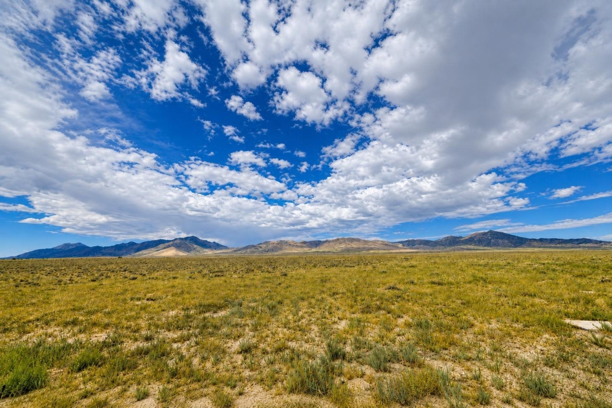
If you are shopping for low-cost rural Utah acreage, the key question is not just the price. It is whether the parcel’s access, zoning, utilities, water, and recorded boundaries fit the way you actually plan to use the land.
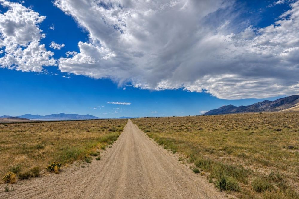
This offering is a 30-acre vacant land parcel on TransAmerica Trl in Grouse Creek, Box Elder County, Utah 84313. The listing identifies parcel 01-055-0003, shows a $13,000 cash price, lists recreational zoning, notes dirt road access, and states that no utilities are available.
The main caveat is that the listing data does not prove buildability, year-round access, road maintenance, water availability, septic approval, or utility extension potential. Those items should be verified with Box Elder County records, maps, and permitting offices before purchase.
Property snapshot: what the listing data shows
The facts below come from the supplied property data. Treat them as a starting point for due diligence, not as substitutes for county records, title review, surveys, or permit confirmations.
This identifies the local jurisdiction and gives buyers the correct county context for assessor, recorder, planning, and GIS searches.
Use this number when checking ownership, tax status, mapped boundaries, and recorded documents.
The parcel has enough scale for rural recreational planning, but acreage alone does not establish legal access or permitted uses.
The price-per-acre figure is useful for comparison, but buyers should compare access, zoning, utilities, and constraints as well as price.
This label should be checked against Box Elder County’s official zoning map and land-use code before assuming any specific use is allowed.
A dirt road note is helpful, but it does not confirm public access, recorded ingress and egress, maintenance responsibility, or seasonal passability.
Any plan involving power, water, septic, a well, RV use, or a structure needs separate feasibility and permit verification.
The listed carrying cost is low, but current taxes, back taxes, special assessments, and liens should be verified through county records.
Grouse Creek and Box Elder County setting
Grouse Creek sits within Box Elder County, a large rural county in northwestern Utah. U.S. Census QuickFacts reports an estimated county population of 65,320 as of July 1, 2025, and a land area of 5,745.60 square miles. That scale matters because rural parcels can vary widely in access, services, emergency response, and utility availability.
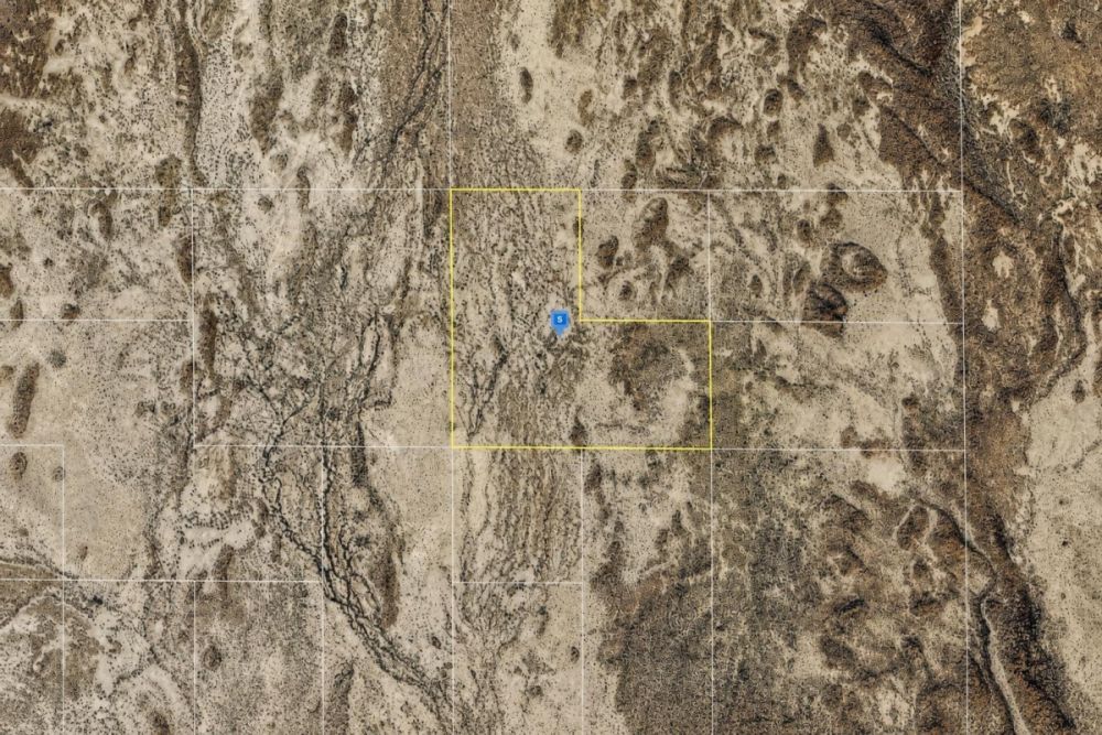
For this specific parcel, the listing places the land on TransAmerica Trl and provides coordinates of 41.221776, -113.796537. Those details help buyers locate the property on maps, but the boundaries, easements, and access route should be confirmed through Box Elder County GIS and recorded documents.
Box Elder County maintains GIS resources that can help buyers review parcel, road, environmental, and zoning layers. The county’s land-use code is also relevant for checking permitted uses, zoning districts, development standards, and flood-damage-prevention rules.
Realistic buyer fit and potential uses
This property is best evaluated as rural recreational acreage or a long-term land holding candidate, not as a ready-to-build homesite. The low cash price and 30-acre size may appeal to buyers who are comfortable doing detailed access, zoning, and off-grid feasibility work before committing.
Any use should be conditioned on Box Elder County zoning, permits, legal access, road conditions, utilities, water, septic, fire and flood considerations, and any recorded restrictions or reservations. The listing’s recreational label does not automatically authorize camping, RV placement, cabins, hunting activity, grazing, or residential construction.
- Day-use recreation or occasional camping, if county rules, access, and any time-limit restrictions allow it.
- Long-term land holding for a buyer who understands taxes, access, and maintenance responsibilities.
- Off-grid planning only after verifying water, septic or waste rules, power alternatives, road access, and permitting requirements.
- Agricultural or grazing concepts only if zoning, water, fencing, access, and any applicable rights or restrictions support that use.
- Outdoor recreation or hunting interest only after confirming lawful access, land-use rules, state hunting regulations, and neighboring land conditions.
Due diligence checklist before you buy
For a remote land parcel with no utilities listed and dirt road access, due diligence is the value of the deal. Work through these checks before you rely on the property for recreation, holding, or future improvements.
Confirm the parcel in county GIS
Search parcel 01-055-0003 in Box Elder County GIS. Compare the mapped parcel to the legal description, coordinates, acreage, nearby roads, and any environmental or zoning layers.
Verify zoning and permitted uses
Ask Planning & Zoning whether the recreational zoning shown in the listing matches the official county records and what uses are permitted on this specific parcel. Confirm rules for camping, RV use, cabins, agricultural activity, and any special permits.
Confirm legal access, not just physical access
The listing notes dirt road access, but buyers should verify recorded ingress and egress, whether TransAmerica Trl is public or private, who maintains it, and whether it is passable during snow, mud, or storm conditions.
Review title, deed chain, and the legal description
The listing shows a Warranty Deed and a legal description in Section 21, Township 6 North, Range 17 West, SLM, with “LESS RES.” included. Have the recorder records and title documents reviewed so you understand ownership, reservations, exceptions, and encumbrances.
Check taxes, liens, and assessments
The listing shows annual taxes of $31.98. Confirm the current tax amount, payment status, back taxes, special assessments, and any recorded liens with the appropriate county records.
Verify utilities, water, well, and septic feasibility
The listing states no utilities. Before planning any off-grid setup, well, septic system, power extension, solar system, or water storage, confirm county and state requirements, provider availability, and practical costs.
Review flood, drainage, terrain, and environmental constraints
Use county GIS and Utah or FEMA-linked flood resources to check whether floodplain, drainage, terrain, wildfire, environmental, or overlay constraints could affect access, use, or future improvements.
Start with Box Elder County’s Land Use Management and Development Code for zoning, permitted-use, development, and flood-damage-prevention context. Pair that with county GIS, assessor, recorder, roads, and permitting offices for parcel-specific verification.
Cash purchase and budget planning
The supplied listing data shows a $13,000 cash price and does not provide owner-finance terms for this parcel. If you need seller financing, confirm directly whether any terms are available; do not assume they exist because rural land is often marketed with a variety of payment structures.
For a no-utilities rural parcel, the purchase price is only one part of the budget. Buyers should also plan for title or closing costs, recording costs, travel and inspection costs, any survey work, access verification, and future off-grid infrastructure if the intended use requires it.
- Is the $13,000 cash price still current and what costs are due at closing?
- Are there any unpaid taxes, liens, special assessments, or recording fees?
- Who pays for title work, deed preparation, recording, and any escrow or closing service?
- If outside financing is needed, will the lender finance remote recreational land with no utilities listed?
How to compare this parcel with other Utah land
At about $433 per acre based on the supplied price and acreage, this parcel may stand out to buyers scanning low-cost Utah land. The stronger comparison, however, is not price alone. Compare zoning, recorded access, road condition, utility availability, water feasibility, terrain, title clarity, and county restrictions.
When comparing Box Elder County rural land, give extra weight to the items that can change your real cost of ownership: whether you can legally reach the parcel, whether the road is seasonal, whether the land is inside any flood or overlay area, and whether your intended use is allowed without expensive or uncertain approvals.
Questions buyers may ask about this property and area
Bottom line for buyers
This 30-acre Grouse Creek parcel is a low-entry-price rural land opportunity with a clear set of listing facts: $13,000 cash price, parcel 01-055-0003, recreational zoning shown, dirt road access shown, no utilities listed, and annual taxes listed at $31.98.
The same facts also define the caution points. No utilities and dirt road access are not small details; they shape what the land can realistically support and what it may cost to use. Before moving forward, verify legal access, zoning, title, flood or overlay status, and utility or water feasibility.
If your goal is simple rural acreage for recreation or holding, and you are comfortable with county-level verification, this parcel may be worth a closer look. If your goal is a cabin, RV setup, residential use, or any improvement, treat county confirmation as essential before you buy.
Ready to review the parcel details?
Open the full listing to check the latest availability, photos, price, and seller-provided property information, then compare it with official county records before making a decision.
Useful verification resources
Use Box Elder County land-use, GIS, assessor, recorder, roads, and permitting resources to confirm zoning, access, taxes, title, flood context, and any intended use before purchase.

You Might Like
Bethune, SC Land for Sale: 0.21 Acres with Paved Road and Public Water
A small Kershaw County lot with RD2 zoning, public water noted, septic needed, and owner financing available.
Lovelock (Owner Financing $328.00 a month) Land Surveyed & Easements!, NV Land for Sale: 39.96 Acres with Owner Finan…
Buyer guide to LC26298: 39.96 acres on Coal Cyn Road with cash pricing, owner financing, and key verification steps.
Lovelock -Owner Financing Deal ( Commercial & Residential Opportunity), NV Land for Sale: 240 Acres with Utilities
Large Pershing County land package with cash and owner-finance pricing, paved access noted, and key zoning checks.