Punta Gorda, FL Land for Sale: 0.23 Acres with Paved Road Access
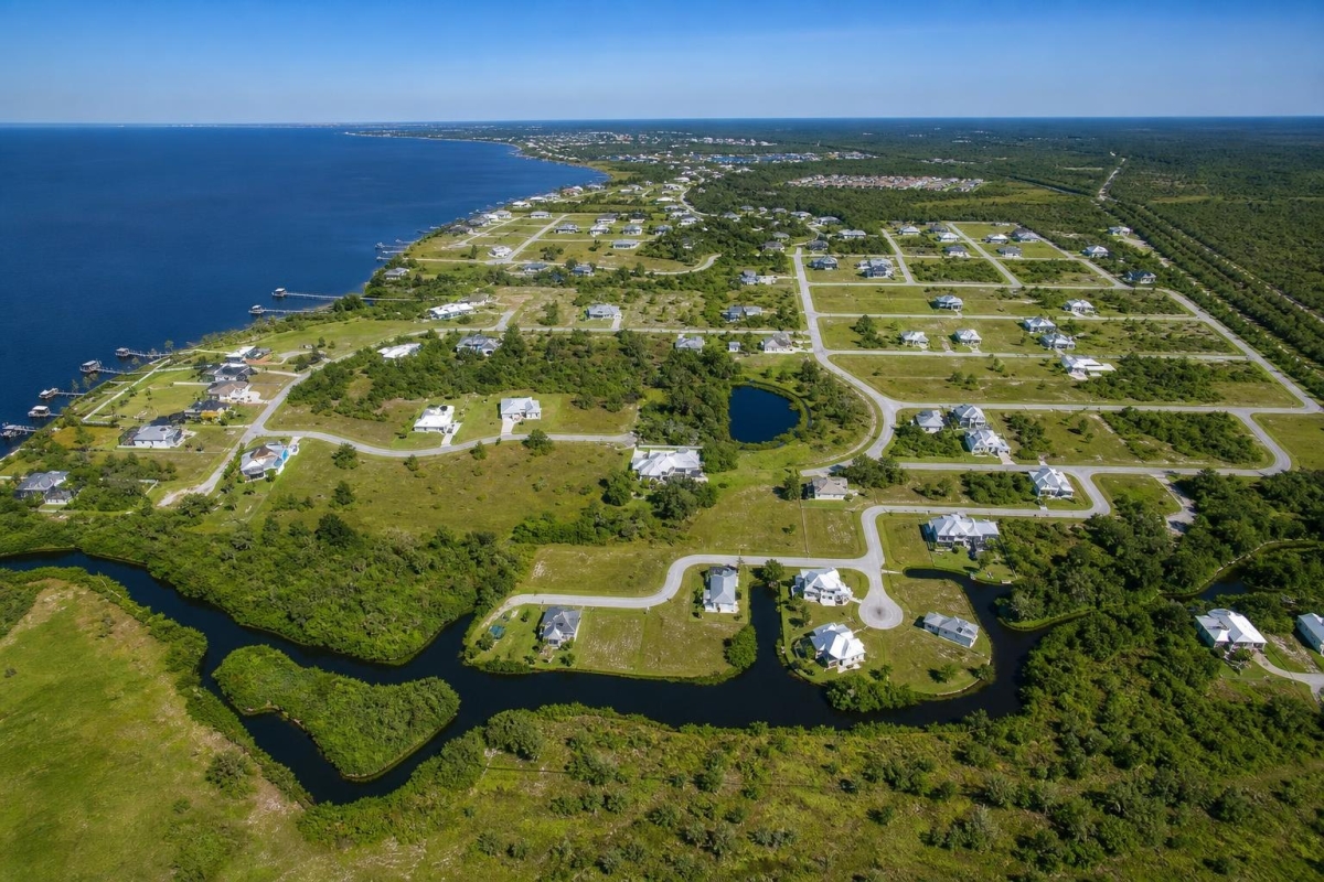
If you are shopping for a small residential lot in Southwest Florida, the smartest first move is to separate the listing facts from the questions that still need official answers. This Punta Gorda parcel has several useful identifiers already available, which makes it easier to research before you spend money on surveys, plans, or closing costs.
The property is located at 29246 Riata Street, Punta Gorda, FL 33982, in Charlotte County. It is listed as 0.23 acres, or 10,019 square feet, with a cash price of $23,500 and parcel number 402312129012.
The main caveat is important: the supplied listing data does not confirm utilities, taxes, HOA or POA status, flood zone, septic or sewer availability, or final buildability. Treat the residential zoning and paved-road listing notes as starting points for due diligence, not as a permit guarantee.
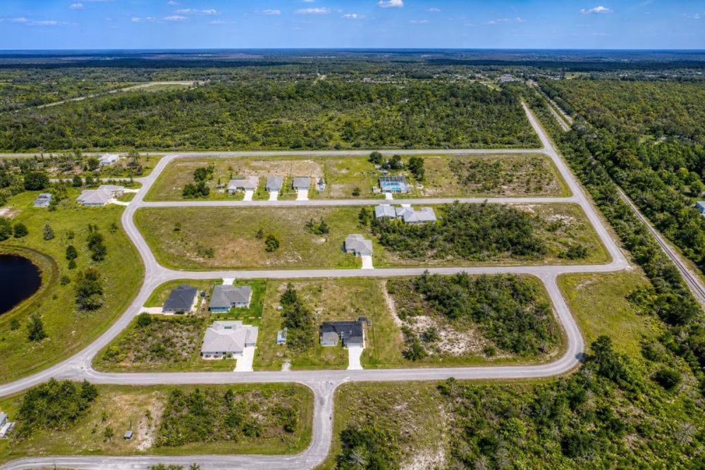
Property snapshot for 29246 Riata Street
These are the core listing facts buyers can use to begin parcel-level research. The explanations focus on what each fact helps you verify next.
Use the address to locate the parcel in map, utility, flood, and neighborhood research tools.
This is the key identifier for county GIS, property appraiser, zoning, tax, and title research.
A small residential lot can be practical, but setbacks, easements, drainage, and utility placement matter.
This is the listed purchase price to compare against closing costs, due diligence costs, and nearby lot alternatives.
Residential zoning is a useful starting point, but the exact district, future land use, overlays, and permit rules still need verification.
The listing notes paved-road access; buyers should still verify frontage, legal ingress and egress, and road maintenance responsibility.
A warranty deed is listed, but it does not replace a title search, lien review, or closing-agent verification.
Utility availability, connection costs, current taxes, and any assessments can materially affect total cost and feasibility.
Area setting: Punta Gorda and Charlotte County due diligence
The supplied property data places this parcel in Punta Gorda, within Charlotte County, Florida. For a buyer, that matters because the parcel number and address can be used to research zoning context, property records, flood layers, and permitting requirements at the county level.
General area context should not be confused with parcel-specific approval. Charlotte County’s public GIS, planning, and flood resources are useful starting points, but the exact rules that apply to this lot should be confirmed by parcel lookup and, if a build plan is being considered, by direct contact with the appropriate permitting office.
In coastal Southwest Florida, flood zone, drainage, elevation, road access, and water or sewer availability can be just as important as the purchase price. Because those details are not fully supplied in the listing package, they should be treated as priority verification items.
Potential uses and buyer fit
This parcel is most relevant to buyers looking at a small residential lot in Punta Gorda, but the right use depends on what official records show. The listing’s residential zoning label and Residential Buildable Land category should be treated as prompts for verification, not as proof that a home can be permitted immediately.
Before budgeting for construction, a buyer should confirm zoning district details, future land use, setbacks, legal access, utility availability, flood requirements, title restrictions, and any HOA or POA obligations.
- Potential future single-family homesite, only if zoning, future land use, setbacks, flood requirements, access, utilities, and permitting rules support the plan.
- Residential land hold for a buyer comfortable verifying taxes, assessments, maintenance obligations, title condition, and long-term market risk.
- Possible assemblage or adjacent-owner opportunity, if a neighboring owner has a lawful use for the parcel and county rules allow the intended combination or use.
- Permitted residential accessory or open-space use, only if allowed by local code, title restrictions, and any applicable association rules.
Due diligence checklist before you buy
Use the address and parcel number to verify the property through official sources before making final assumptions. For this lot, Charlotte County GIS is the best starting point for parcel-level research, but it should be paired with planning, flood, utility, title, and tax checks.
Pull the parcel in Charlotte County GIS
Search by parcel number 402312129012 and confirm the parcel location, map boundaries, zoning context, future land use layers, and any mapped overlays that may affect development.
Confirm the exact zoning and jurisdiction
The listing says Residential, but buyers should verify the exact zoning district, future land use designation, minimum lot standards, setbacks, and whether city or county development rules apply.
Check flood, drainage, and elevation issues
Review official flood information and FEMA-related map resources, then consider elevation, drainage, stormwater, wetlands, and insurance implications before planning improvements.
Verify utilities before assuming service
The listing does not specify utilities. Ask the appropriate providers about water, sewer, electric availability, connection costs, and whether septic review would be required if public sewer is unavailable.
Verify legal access and road maintenance
The listing notes paved road access, but buyers should confirm frontage, legal ingress and egress, whether the road is public or private, and who maintains it.
Research taxes, assessments, and association obligations
Because taxes and HOA or POA details are not supplied, check property appraiser and tax records and ask about special assessments, delinquent taxes, deed restrictions, or association dues.
Review title, deed, and legal description
Confirm that the parcel number, legal description, deed type, seller authority, liens, easements, and recorded restrictions are consistent through a title company or closing professional.
Consider a survey before building plans
A survey can help confirm boundaries, encroachments, easements, and the practical buildable envelope, especially on a small lot where setbacks and utility placement can matter.
Charlotte County GIS is the selected official source because it supports parcel-level map research, zoning context, future land use review, and other location-based checks. Use it as a starting point, then confirm details with planning, flood, utility, property appraiser, and title professionals as needed.
Financing and cash-buyer planning
The supplied data shows a cash price of $23,500 and does not show owner-financing terms. If financing is important, confirm directly whether any terms have changed before assuming they are available.
A cash buyer should still budget beyond the purchase price. Title work, recording, closing costs, surveys, utility availability checks, flood research, and potential site-planning expenses can all affect the true cost of taking the lot from purchase to usable plan.
- Is $23,500 cash the only current pricing shown, or have terms changed?
- What closing costs, title fees, recording fees, and prorated taxes should be expected?
- Will a third-party lender require a survey, flood review, or proof of legal access?
- Are there special assessments, association dues, or delinquent taxes in official records?
How to compare this lot with other Punta Gorda land
Do not compare this property by price and acreage alone. For a 0.23-acre residential lot, utility availability, flood status, elevation, setbacks, legal access, title condition, and permitting path may matter more than the headline size.
When reviewing other Charlotte County or Florida land options, line up the same facts side by side: parcel number, address, zoning, future land use, road access, utilities, taxes, association obligations, flood zone, survey needs, and estimated cost to make the site usable.
Questions buyers may ask about this property and area
Bottom line
LC18603 is a clearly identified 0.23-acre residential land listing in Punta Gorda, with a $23,500 cash price, parcel number 402312129012, a listed Warranty Deed, and paved-road access noted in the property data.
The opportunity depends on what due diligence confirms. The missing items are not minor: utilities, taxes, HOA or POA status, flood zone, sewer or septic feasibility, exact zoning details, and buildability can all change the cost and practicality of the lot.
For a buyer willing to verify the parcel through Charlotte County resources, utility providers, title review, and possibly a survey, this Riata Street lot may be worth a closer look. If you need a shovel-ready site with confirmed services and permit path, complete those checks before relying on the property for a specific build plan.
Ready to review 29246 Riata Street?
Open the full listing to confirm current availability, review the property details, and contact the listing representative with parcel-specific questions.
Helpful next steps
Use the parcel number, address, and Charlotte County GIS as your starting points, then verify flood, utilities, taxes, title, access, and permitting before making final decisions.
You Might Like

Your Investment Options - Stocks VS Real Estate: Fight!
Stocks vs. real state: which is the better investment? Thats like asking whether chocolate is better than vanilla. Its difficult to answer this question simply because it ultimately comes down...

8 Easy Ways to Find Land to Build On
When most people search for land, they do so with the intention of building on the plot. Maybe they want to build their dream home. Maybe they want to build...

Where to Get Cheap Rural California Land
Whether its always been your dream to own some land, or you just feel that nows the right time to buy; if its a business proposition or if you want...