13.1 Acres of Land for Sale in Rockport, Arkansas with No Zoning Listed
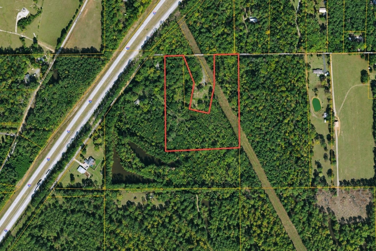
If you want Arkansas acreage that can be evaluated for both recreation and a possible future rural homesite, this Rockport listing deserves a careful look rather than a quick skim.
LC27095 is a 13.1-acre vacant land parcel in Rockport, Hot Spring County, Arkansas 72104. The advertised cash price is $64,900, and the supplied parcel identifier is 023-00640-000 (13.1 ac).
The important caveat is that the structured listing data does not provide road access, utilities, taxes, legal description, deed type, or flood-zone determination. It does list the zoning field as No Zoning, but buyers should verify what that means locally before treating any use as approved or buildable.
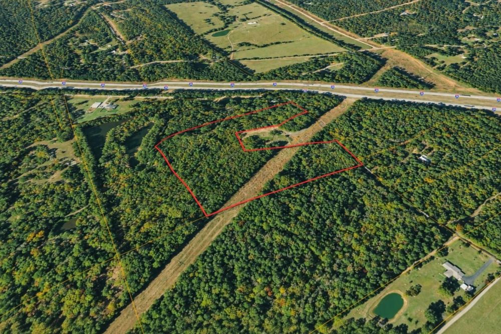
Property snapshot for LC27095
The listing has several clear, useful facts and several items that still need direct verification. Here is what the supplied data establishes and why each point matters to a buyer.
Use this LandCentury reference when asking about the listing or matching the article to the live property page.
This is the key number to use when checking assessor, GIS, tax, mapping, and title records.
The size gives room to consider rural, recreational, or long-term ownership uses, but the practical usable area still depends on access, terrain, drainage, and restrictions.
This is the listed cash price. Buyers should still budget separately for closing costs, title work, survey work, inspections, and any development research.
County and local jurisdiction matter for property records, permits, tax questions, flood review, and utility research.
Coordinates help orient map research and site planning, but they should not replace a survey, title review, or official parcel map.
This is a useful data point, not a blanket approval. Buyers should still confirm county, city, subdivision, deed, septic, floodplain, and building requirements.
This is one of the biggest due-diligence areas. Verify legal access and service availability before planning a homesite, cabin, campsite, or regular recreational use.
Rockport and Hot Spring County setting
The parcel is identified in Rockport, within Hot Spring County, Arkansas. The property-specific facts supplied are the 13.1-acre size, the parcel number, the ZIP code, and the coordinates. Details such as the condition of access, the availability of power or water, and the exact usable area are not supplied and should be verified separately.
For a rural land buyer, county records are often the most practical starting point. The Hot Spring County Assessor is the local contact for parcel, assessment, and tax-record questions, and Arkansas GIS can provide broader map-based context. Those sources can help confirm whether the parcel number and mapped location line up with the listing data.
Flood review should also be part of the location work. FEMA flood-hazard information is available for Arkansas locations including Rockport and Hot Spring County, which makes a flood-screening step relevant before planning a driveway, structure, septic system, or long-term improvement.
The broader Hot Spring County area is associated with outdoor recreation, including county-highlighted resources such as Lake Catherine State Park. That general lifestyle context may be appealing, but it should not be substituted for parcel-level research on access, boundaries, restrictions, and physical conditions.
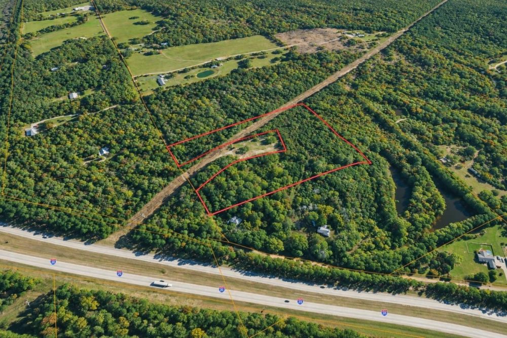
Buyer fit and realistic use possibilities
At 13.1 acres, this property offers more scale than a small residential lot, which is why it may attract buyers looking for privacy, outdoor use, or future rural improvements. The listing categories include Recreational & Hunting Land and Residential Buildable Land, but those category labels should not be read as legal guarantees.
The best way to evaluate this land is to choose your intended use first, then test that use against access, title, utilities, water, septic, flood risk, local rules, and recorded restrictions. No buyer should assume that a structure, driveway, well, septic system, camping setup, or hunting use is allowed or practical without verification.
- Recreational base: The acreage may be considered for weekend recreation or outdoor use if legal access, boundaries, terrain, safety rules, and any local or recorded restrictions support that plan.
- Hunting-oriented ownership: Because the property is categorized as recreational and hunting land, it may interest hunters, but buyers should verify legal access, property boundaries, Arkansas hunting regulations, firearm or discharge rules, and any private restrictions before relying on that use.
- Possible rural homesite or cabin site: The listing also carries a residential buildable category, but buildability must be confirmed through access, floodplain, septic, well or water service, power availability, driveway standards, setbacks, permits, and title review.
- Long-term land hold: A buyer who wants acreage exposure without immediate construction should still check taxes, maintenance obligations, access rights, and any easements or covenants that could affect resale or future plans.
- Private retreat or occasional campsite: Short-term or seasonal use may be possible only if camping, waste handling, fires, vehicle access, and utility needs comply with local rules and site conditions.
Due diligence checklist for parcel 023-00640-000
The listing gives enough information to start a serious evaluation, but the most important purchase questions are still open. Use this checklist before making an offer or planning improvements.
Confirm parcel identity, acreage, and mapping
Start with the parcel number 023-00640-000 and compare it against the Hot Spring County assessor record and available GIS mapping. Confirm that the mapped tract, acreage, owner record, and tax record match the listing. If the assessor record treats the land differently than the listing, resolve that before relying on the advertised size or location.
Verify legal access before closing
Road access is not provided in the structured data. Determine whether the parcel fronts a public road, is served by a private road, or depends on a recorded easement. If access is by easement, confirm the recorded terms, maintenance obligations, width, and whether the access is usable for your intended vehicle, construction, or emergency-service needs.
Get utility availability in writing
Do not assume water, sewer, power, internet, or other services are available at the property line. Contact relevant utility providers and ask about service availability, line-extension costs, connection requirements, and timelines. If public water or sewer is not available, evaluate well and septic feasibility before treating the parcel as suitable for a residence.
Check septic, well, and building requirements
The zoning field is listed as No Zoning, but that does not eliminate permit requirements or site constraints. If you want to build, confirm the county or local process for septic approval, driveway permits, building permits, minimum standards, setbacks, floodplain rules, and any inspection requirements before assuming a home, cabin, or accessory structure is feasible.
Screen flood, drainage, and site conditions
Use FEMA flood-hazard resources and available map layers to see whether the parcel lies in or near a flood-prone area. If any concern appears, investigate build-pad location, driveway placement, drainage, septic feasibility, and insurance implications. Flood review is especially important before spending money on design, clearing, or utility planning.
Review title, legal description, and easements
The supplied data does not include a legal description or deed type. Before closing, obtain a title review that confirms ownership, legal description, recorded easements, encroachments, restrictions, access rights, and any liens. A survey may also be appropriate if boundaries, access, or improvement locations are material to your purchase.
Confirm taxes and assessment status
No tax amount is supplied in the listing data. Check the county assessor and tax records to confirm assessed value, tax history, current tax status, and whether the parcel is treated as a single 13.1-acre tract. This helps avoid surprises and gives you a better estimate of annual holding costs.
Walk the property with a purpose
A site visit should test the assumptions you made from maps. Look for practical access, gates, visible boundary clues, terrain changes, drainage issues, neighboring uses, debris, signs of use, and any obstacles that could affect recreation or building plans. If you are unfamiliar with rural land, consider bringing a surveyor, contractor, or local land professional.
The most useful official starting point is the Hot Spring County Assessor because it is directly tied to parcel, assessment, and tax-record verification. Use the parcel number from the listing when contacting or searching county records, then supplement that work with Arkansas GIS and FEMA flood resources as needed.
Price and financing notes
The supplied listing data shows a cash price of $64,900 and does not provide owner-finance pricing, deposit information, or seller financing terms. It is also not marked as an auction. If you need financing, confirm directly whether any seller terms exist or plan to speak with a lender that handles land loans.
Land financing can be different from a standard home mortgage. Lenders may ask about legal access, surveyed boundaries, title, appraisal, utilities, and the intended use. Even a cash buyer should budget for due diligence, closing costs, title work, survey work, and any utility or septic research before deciding what the property truly costs to own.
- Are any seller-financing terms available even though none are listed in the structured data?
- What total cash is needed for purchase, closing, title work, and due diligence?
- Will a land lender require confirmed legal access, a survey, or utility information?
- If the goal is building later, how will septic, well, driveway, and utility costs affect the real budget?
How to compare this Rockport acreage
Using the supplied figures, the advertised cash price works out to roughly $4,954 per listed acre before closing costs or due-diligence expenses. That calculation is a starting point for comparison, not a valuation opinion.
When comparing this parcel with other Arkansas acreage, do not compare price and size alone. Confirmed road frontage, legal access, utilities, flood status, septic feasibility, taxes, deed restrictions, and survey clarity can matter as much as acreage.
A parcel with more verified infrastructure may look more expensive upfront but reduce uncertainty. A parcel with missing access or utility information may still be attractive, but the buyer should price in the time and cost needed to answer those questions before closing.
Questions buyers may ask about this property and area
Bottom line for buyers
LC27095 is straightforward in the facts it gives: 13.1 acres in Rockport, Hot Spring County, parcel number 023-00640-000, a $64,900 cash price, and a zoning field listed as No Zoning. Those facts make it a clear property to begin researching.
The main decision point is not whether the acreage looks interesting on paper. It is whether the buyer can verify the practical items that determine real usability: access, utilities, flood exposure, title, taxes, septic or well feasibility, and any local or recorded restrictions.
For the right buyer, this is a focused Arkansas acreage opportunity with enough size to justify deeper due diligence. For a buyer who needs a fully confirmed homesite with known services, the missing access and utility details should be answered before moving forward.
If you are still comparing acreage types, it is worth browsing other affordable land for sale options to see how access, utilities, parcel size, and local records change the real ownership picture.
Ready to evaluate the full listing?
Review the gallery, map information, and seller-provided details, then use the due-diligence checklist to ask direct questions before making a decision.
Official records to check
Use the parcel number when checking county assessment records, GIS mapping, and flood resources. If your plan involves building, also contact the appropriate permitting and utility offices before relying on any improvement plan.
You Might Like

Haviland, AZ Land for Sale: 1.25 Acres with Owner Financing Available
A practical guide to LC24437 on Fireside Dr: price, terms, utilities, access, and Mohave County checks.

Where to Buy Hunting Acreage in Texas, Iowa, Ohio and Nebraska
If youre thinking of purchasing hunting land for sale, there are only a handful of states that will give you the best value for your money. Prime hunting spots can...

Owner Financed Land for Sale - Advantages and Downsides
When you read about land investing, and even some of the posts on our blog, youll see a lot of talk about owner financing. You may even read that this...