Fallon (Owner Finance for $1,399.00 a month) No Credit Check, NV Land for Sale: 640 Acres with Owner Financing
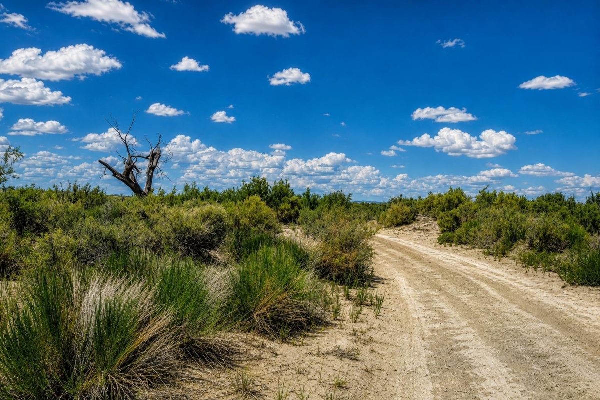
For buyers looking at large Nevada acreage rather than a small subdivision lot, the real question is not just how much land is available. It is what can be verified before money changes hands: access, zoning, utilities, title, and the actual path to using the property.
LandCentury property LC25678 is listed as 640 +/- acres on Timber Lake Road in the Fallon area of Churchill County, Nevada 89496. The supplied data shows a $189,000 cash price, a $219,000 owner-finance price, and parcel/APN references of 003-731-1999 and 003-731-19.
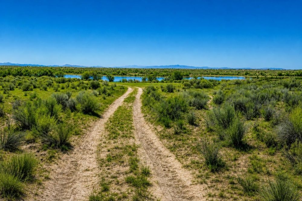
The listing notes Residential zoning, dirt road access, and city utilities available. Treat those as starting points for due diligence, not guarantees of buildability, installed service, legal road rights, or year-round access.
Property snapshot: what the listing data shows
The details below come from the supplied LandCentury property package. Several items are important precisely because they need to be confirmed through county, title, and utility records before a buyer relies on them.
Use this reference when discussing the listing with LandCentury or the seller.
This anchors the parcel for county GIS, mapping, access, and local permitting research.
The APN appears in two formats in the supplied data, so buyers should confirm the exact county record format.
A full-section-style legal description is useful for title review, boundary checks, and confirming whether any exceptions apply.
A large tract changes the due-diligence focus toward access, mapping, utility feasibility, and permitted uses.
The financed purchase option is a different price structure and should be reviewed separately from the cash offer.
These are listing notes, not independent confirmations of legal access, maintenance, or service at the parcel boundary.
Each item should be checked against title, county planning, and tax records before closing.
Fallon and Churchill County setting
Fallon is the county seat of Churchill County, and county resources are central to evaluating land in this area. For a large rural parcel, the most useful local context is not tourism or lifestyle language; it is which public offices handle parcel mapping, zoning, permits, road questions, and land-use review.
The parcel-specific information supplied for this listing places the land on Timber Lake Road with coordinates of 39.6590523, -118.6431054. The data lists dirt road access and city utilities available, but it does not include a survey, title report, utility letter, road maintenance confirmation, flood determination, or septic approval.
Churchill County’s planning and building functions are relevant because buyers may need answers about zoning designation, permitted uses, special use permits, building permits, land division rules, setbacks, and utility or wastewater requirements. County GIS is also an appropriate starting point for comparing the APN, legal description, mapped boundaries, and surrounding land-use context.
Potential uses and buyer fit
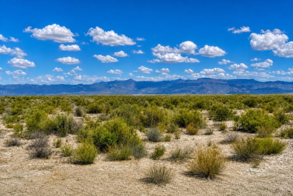
This property is best evaluated as large-acreage vacant land with a residential zoning label in the supplied data and listing categories that include residential buildable land, agricultural and farm land, mobile home and RV land, owner finance deals, and vacant land. Those categories describe possible buyer interest, not approved uses.
A realistic buyer should start with a specific plan, then verify whether that plan is allowed. Residential construction, manufactured-home placement, RV use, agricultural activity, accessory structures, fencing, internal roads, wells, septic, utilities, and long-term holding all depend on zoning, permits, access rights, water availability, wastewater rules, title restrictions, and any recorded easements.
- A buyer seeking large private acreage near the Fallon area, subject to confirming legal access and practical year-round reach.
- A future residential or manufactured-home site only if Churchill County confirms the zoning district, permitted use, setbacks, access, water, septic or sewer, and building requirements.
- A rural land holding for buyers who value scale and are comfortable verifying infrastructure before improvement.
- Agricultural, grazing, or open-land concepts only after confirming water rights or water availability, fencing rules, allowed uses, and any environmental or county limitations.
- RV, camping, or recreational use only if county code, sanitation rules, duration limits, access, and any restrictions allow it.
Due diligence checklist before buying
Use the supplied listing facts as a starting point, then verify the records that control ownership, access, allowed uses, and development feasibility. These checks are especially important because the parcel is large and the listing uses terms that need official confirmation.
Confirm the APN and mapped boundaries
Search the parcel/APN references 003-731-1999 and 003-731-19 in Churchill County GIS, then compare the map, legal description, acreage, road name, and neighboring parcels.
Match the legal description to title records
Ask for a title report and confirm that T21N, R30E, all of Section 29 matches the parcel being sold, with no unexpected exclusions, encumbrances, access gaps, or boundary issues.
Verify zoning and permitted uses
Do not rely only on the listing’s Residential label. Confirm the exact zoning district, permitted uses, setbacks, minimum requirements, and whether a home, manufactured home, RV use, agricultural use, or accessory structures would be allowed.
Confirm legal and physical access
The listing states dirt road access. Verify whether Timber Lake Road or any connecting route provides recorded legal access, who maintains it, whether it is public or private, and whether conditions support the buyer’s intended use.
Check utility serviceability
The listing says city utilities are available, but that may not mean service is installed at the parcel boundary. Confirm water, sewer, power, meters, extension costs, easements, and provider requirements directly with the relevant utility and county offices.
Evaluate water and wastewater options
If sewer service is not confirmed at the site, ask about septic feasibility, soils, permitting, setbacks, and any testing or engineered design requirements before planning a dwelling or RV setup.
Review taxes and assessments
The supplied data lists taxes as 300 but does not state the tax year. Check the county tax roll for current taxes, delinquency status, special assessments, district charges, and exemptions.
Screen for flood, drainage, and environmental constraints
Use official mapping and county resources to check flood-prone areas, drainage corridors, terrain issues, wetlands, or other constraints that could affect roads, pads, structures, or utility work.
Churchill County GIS and Mapping is the best official starting point for parcel location and map-based verification. Pair it with county planning and building staff for zoning, permit, land division, and development questions.
Owner-finance terms to review carefully
The supplied listing data shows a $189,000 cash price and a $219,000 owner-finance price. The owner-finance terms list a $6,500 down payment, $1,399 per month for 240 months, plus an $11 loan processing fee and a $199 document fee.
Owner financing can reduce the upfront cash barrier for buyers who do not want or cannot obtain conventional land financing. It also requires careful review because the financed price, payment schedule, default rules, prepayment terms, deed timing, taxes, insurance obligations, and closing costs can materially affect the deal.
- Is the deed transferred at closing or after the financing balance is paid?
- Is there any prepayment penalty or balloon payment?
- What happens if a payment is late or missed?
- Who is responsible for property taxes, insurance, recording fees, and any assessments during the finance term?
- Are the listed processing and document fees the only fees, or are there additional closing costs?
- Will the buyer receive a title report and have the opportunity to review easements and restrictions before signing?
How to compare this parcel with other Nevada land
Compare this property against other Churchill County and Nevada land by more than price per acre. For a 640 +/- acre tract, legal access, utility feasibility, water and wastewater options, terrain, zoning, and title clarity can outweigh a simple acreage calculation.
The owner-finance option may appeal to buyers focused on monthly affordability, while the cash price gives a cleaner baseline for market comparison. A smaller parcel with confirmed utilities and road maintenance may be a better fit for some buyers; a larger tract with more verification work may fit buyers who value scale and are comfortable with due diligence.
Questions buyers may ask about this property and area
Bottom line for buyers
This 640 +/- acre Fallon-area parcel is a scale opportunity with a clear set of listing facts: APN references, a full-section-style legal description, a cash price, an owner-finance option, and notes for Residential zoning, dirt road access, and city utilities available.
It is not a property to evaluate on acreage alone. The right buyer will be willing to verify county zoning, legal access, utility serviceability, water and wastewater options, taxes, title, and any environmental or road constraints before committing.
The next step is practical: review the full listing, gather the parcel information, and use Churchill County records to confirm whether the land supports your intended plan.
Interested in LC25678?
Review the full property listing, confirm the terms, and start county-level due diligence before making a decision.
Helpful LandCentury resources
Compare this property with other Nevada land, vacant land listings, and owner-finance land opportunities to understand how price, access, utilities, and terms differ across available parcels.

You Might Like
Greers Ferry Lake (Double Lot), AR Land for Sale: 0.84 Acres with Paved Access & City Utilities
A $1,345 double lot on Lakeside Drive with residential zoning listed and city utilities noted as available.

Romance, History and Innovation Thrives in Tennessee
Can you hear the refrain, Davy Davy Crockett! King of the wild frontier screeching in your head? Are Civil War battlefields stirring your heart to go out and find...

Where to Buy Hunting Acreage in Texas, Iowa, Ohio and Nebraska
If youre thinking of purchasing hunting land for sale, there are only a handful of states that will give you the best value for your money. Prime hunting spots can...