Mile High, TX Land for Sale: 10 Acres with Dirt Road Easement
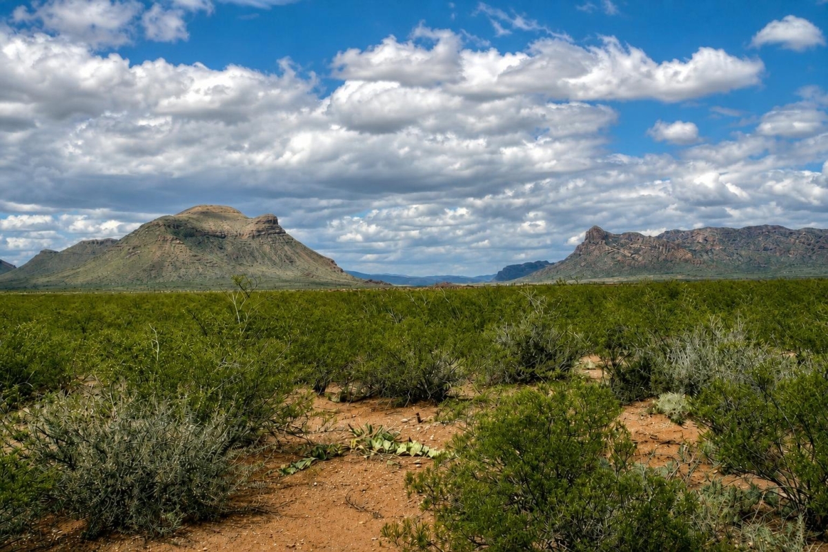
For buyers who want inexpensive West Texas acreage and are comfortable researching remote, utility-free land, this parcel is a straightforward candidate to study. The appeal is acreage and a low listed cash price, not a ready-to-build homesite claim.
LC25098 is a 10-acre vacant land parcel at 1300 Green River Road in Mile High, Hudspeth County, Texas, listed with a $4,000 cash price. The supplied data identifies parcel number 55503, a Warranty Deed, Recreational zoning, dirt road easement access, no utilities, and annual taxes listed at $18.00.
The main caveat is verification. Before relying on the land for recreation, camping, hunting-related use, future improvements, or long-term holding, confirm the legal description, recorded access, tax status, utility options, water and septic feasibility, and any county permit or floodplain requirements.
Property Snapshot
These are the core listing facts to use as a starting point, with the practical meaning of each item for a land buyer.
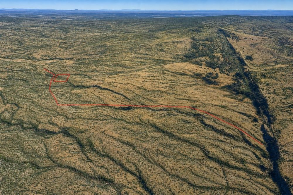
Gives a map starting point, but parcel boundaries should still be confirmed through county records or a survey.
The parcel number and listing ID help keep county, title, and seller communications aligned.
Acreage defines the basic land area for recreational planning, access review, and comparison with other parcels.
This should match deed, county clerk, appraisal district, and any title or survey documentation.
The listed carrying cost is low, but the current tax bill and any other charges should be verified before closing.
The listed deed type is useful, but it does not replace title review or confirmation of recorded documents.
Treat this as a listing fact until Hudspeth County records or officials confirm how the parcel may actually be used.
This points to an off-grid land purchase where legal access, road condition, water, power, and septic questions matter.
Mile High and Hudspeth County Setting
Hudspeth County is a large, rural West Texas county with expansive desert terrain and sparse development. That general setting can appeal to buyers seeking space and privacy, but it also makes due diligence more important than it would be for a utility-served subdivision lot.
The parcel-specific facts are narrower: this listing is for 10 acres in Mile High, with no utilities and access listed as a dirt road easement. The supplied data does not confirm road condition, maintenance responsibility, water availability, septic suitability, flood status, or building eligibility.
County and appraisal district resources are especially important here. For remote land, buyers should use parcel records, deed documents, access documentation, and development-permit guidance to confirm whether the property fits the intended use.
Potential Uses and Best Buyer Fit
This parcel is best viewed as remote, off-grid recreational land unless official local review supports a broader use. The listing does not establish utility service, water, septic approval, road quality, or buildability.
A good fit is a buyer who wants low-cost acreage and is willing to complete county, title, access, and site due diligence before making plans. A poor fit is a buyer who needs confirmed utilities, immediate residential construction, or lender-ready development documentation.
- Recreational retreat or camping base, only if county rules, access, and any site restrictions allow that use.
- Hunting-related or outdoor use, subject to Texas regulations, safe access, boundary confirmation, and neighboring land considerations.
- Off-grid basecamp concept, if temporary-use rules, waste disposal, water supply, and road access are verified first.
- Long-term land hold for a buyer comfortable with remote ownership and no listed utilities, without assuming future appreciation or development rights.
- Low-intensity agricultural or grazing concept, only after confirming water, fencing, soil, access, and any county or deed restrictions.
Due Diligence Checklist for This Parcel
Use the listing data as a starting point, then confirm the important details through official records, title review, and on-the-ground inspection when possible.
Match the parcel in official records
Search Hudspeth County appraisal records using parcel number 55503 and compare the acreage, legal description, location, and tax information against the listing.
Review deed and title documents
The listing states Warranty Deed. Before closing, review the deed history, legal description, ownership chain, and any exceptions or restrictions with a title professional or county-record search.
Verify the dirt road easement
Confirm that the easement is recorded, legally sufficient, physically usable, and connected to a practical access route. Also ask who maintains the route and whether it is public, private, or easement-based.
Confirm utilities, water, and septic options
The listing states no utilities. Contact relevant providers and county offices before assuming electric extension, hauled water, well potential, septic approval, or off-grid systems will be workable.
Clarify zoning, permitted uses, and development review
Verify whether Recreational is a county-recognized zoning or use category or a listing classification. If improvements are planned, ask about building, development, floodplain, and wastewater requirements.
Verify taxes and carrying costs
Annual taxes are listed at $18.00, but buyers should confirm the current tax year, any unpaid balances, exemptions, special valuations, and future reassessment risk.
Inspect boundaries and site conditions
Use maps, a survey if needed, and a site visit when possible to review boundaries, road condition, drainage, erosion, floodplain concerns, and nearby land uses.
For official parcel research, the Hudspeth Appraisal District property search is the best starting point. Use parcel number 55503 and the legal description to compare appraisal, acreage, ownership-related, and tax details before relying on the listing alone.
Cash Purchase and Cost Questions
The supplied data lists a $4,000 cash price and a $5 deposit. It does not list owner-finance pricing or terms, and the property is not marked as an auction.
Because the listing states no utilities, the purchase price is only one part of the budget. Buyers should also think through title work, recording costs, site inspection, survey needs, access verification, and utility, water, or septic feasibility before committing.
If monthly payments are important, compare this parcel with listings that expressly publish owner-finance terms rather than assuming financing is available here.
- Is the $5 deposit credited to the purchase price, refundable, or subject to specific conditions?
- What closing, recording, document, title, or transfer costs are separate from the $4,000 cash price?
- Who prepares and records the deed, and when does recording occur after closing?
- Can the buyer obtain title insurance or a survey if extra verification is desired?
How to Compare This Land With Other Texas Parcels
This parcel competes on acreage and low cash entry price. The tradeoff is its remote, off-grid profile: access is listed as a dirt road easement and utilities are listed as none.
When comparing Hudspeth County land, line up the same facts for each parcel: acreage, parcel number, legal description, deed type, taxes, recorded access, road condition, utility status, water and septic path, zoning or use label, and county-record match.
If you need existing utilities, easier year-round access, or a clearer residential path, a different parcel may be more practical even at a higher price. If you are comfortable with remote-land verification, LC25098 is worth evaluating on its documented facts.
Questions buyers may ask about this property and area
Bottom Line
LC25098 is best understood as a low-cost, 10-acre Hudspeth County land option for a buyer who values space and can complete careful remote-land due diligence. The verified listing facts are straightforward: $4,000 cash price, parcel 55503, Warranty Deed listed, Recreational zoning, dirt road easement access, no utilities, and annual taxes listed at $18.00.
Those same facts define the work ahead. Dirt road easement access and no utilities mean access rights, road condition, power, water, septic, permits, and floodplain questions should be answered before purchase.
If the intended use is recreation, a simple off-grid base, or a long-term hold, this parcel may be worth a closer look once county records and physical access check out. If the plan depends on immediate building or service connections, verify those items first.
Ready to evaluate LC25098?
Review the full listing details, then compare them with Hudspeth County records and your intended use before moving forward.
Helpful next steps
Use the full LandCentury listing for seller and purchase details, the Hudspeth Appraisal District for parcel verification, and related Texas or vacant-land inventory if you want to compare other options.
You Might Like

Land for Sale in Nevada - Securing the Best Deals Possible
Known as the Silver State, Nevada is home to the iconic town of Las Vegas and is the 7th most extensive state in the U.S. Although the state is comprised...

Discovering the Charm of Horseshoe Bend, Arkansas
In the heart of the Ozark Mountains, Horseshoe Bend stands out as a refreshing escape. This small city, with a population hovering around 2,000, offers a quiet retreat from the hustle and bustle of everyday life, making it a delightful discovery for visitors and a cherished home for residents.

Flipping Houses or Rental Properties - Which Is More Profitable?
You're ready to invest in real estate, but you've hit a brick wall: you don't know whether to rent out your new property, or flip it for a quick profit....