0.33 Acres of Residential Land for Sale in Greer Lake, Arkansas, with Paved Road Access
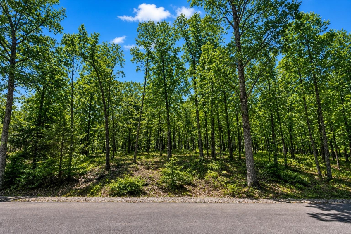
If you are comparing low-entry Arkansas land, this is the kind of small residential lot where the numbers look simple but the verification matters.
LC22949 is a 0.33-acre vacant parcel on Courtshire Street in the Greer Lake area of Van Buren County, Arkansas, ZIP 72956. The supplied parcel number is 4410-02042-0000, and the cash price is $798.
The listing data notes Residential zoning and paved-road access, but utilities are not confirmed. Buyers should contact the county and relevant providers before treating the lot as build-ready or suitable for any specific use.

Property snapshot: the facts to verify first
The supplied data gives a clear starting point for researching the parcel, but several buyer-critical items still require official confirmation.
Use this ID when checking assessor records, tax status, GIS maps, and title documents.
This is the listing reference to use when asking LandCentury or the seller about this exact lot.
This identifies the local county context, but the parcel should still be matched in official records and mapping tools.
The subdivision reference is a prompt to review plats, covenants, easements, and any recorded restrictions.
Small residential parcels can be affected quickly by setbacks, septic placement, drainage, and driveway requirements.
The price is clear, but the tax field needs official context because the supplied data does not define the period or status.
A warranty deed is useful, but it should not replace a title search and review of liens, easements, or unpaid taxes.
Zoning and access are helpful starting points, while utility availability remains an open verification item.
Greer Lake and Van Buren County setting
For due diligence, the most important geography is Van Buren County. County offices are the likely starting point for parcel records, tax questions, deed research, and local contacts. If official research shows that a city or special planning jurisdiction applies, that may add another layer of rules.
The supplied location places the lot on Courtshire Street in the Greer Lake area, with coordinates 35.4542552, -94.3542807. Those coordinates can help a buyer compare the listing location against county mapping, FEMA flood-map tools, and any on-the-ground review.
The legal description references Lakewood Hills SD: 03F. Treat that as a practical due-diligence flag: check recorded subdivision documents, access obligations, possible use restrictions, and any association or maintenance responsibilities before purchase.
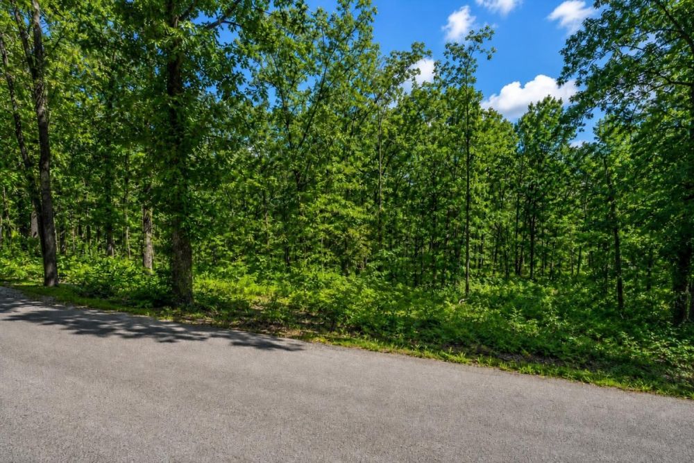
Potential uses: realistic buyer fit for a small residential lot
Think of this as a small residential-lot candidate, not a finished homesite. The price, size, Residential zoning label, and paved-road access make it worth a closer look for a buyer who is comfortable doing county-level verification.
Any use should be conditioned on current zoning, permits, legal access, utility availability, water, septic or sewer options, flood status, and recorded subdivision restrictions.
- Future single-family homesite research, only if setbacks, minimum lot rules, permits, utilities, drainage, and septic or sewer requirements work for the parcel.
- Manufactured-home or mobile-home research, only if local code and any Lakewood Hills subdivision restrictions allow that specific use.
- RV-related ownership or temporary use research, only where zoning, sanitation, parking, time-limit rules, and utility access allow it.
- Low-entry buy-and-hold land position for a buyer who first confirms title, taxes, access, restrictions, and any dues or assessments.
- Possible add-on lot for a nearby owner seeking extra space, subject to deed review, boundary confirmation, and local rules.
Due diligence checklist before buying Parcel 4410-02042-0000
Use the parcel number, legal description, street location, and coordinates together. A low price does not remove the need to confirm title, access, utilities, tax status, and land-use rules.
Match the parcel in official records
Search county assessor or GIS records using parcel number 4410-02042-0000. Confirm the owner, acreage, legal description, mapped location, and whether the parcel shown matches the lot being offered.
Verify title and the Warranty Deed path
The supplied deed type is Warranty Deed, but buyers should still request a title search or attorney/title-company review. Look for liens, easements, old tax issues, boundary conflicts, or recording problems.
Confirm zoning and buildability with local offices
The supplied zoning is Residential. Ask the relevant planning or building authority whether a site-built home, manufactured home, or RV use is allowed, and confirm setbacks, minimum lot size, permits, and inspection requirements.
Get utility answers in writing
Utilities are not confirmed in the listing data. Ask the county and local providers about electric service, water, sewer, septic feasibility, tap fees, extension costs, and whether any prior utility connections exist.
Check road frontage and driveway requirements
The access field says Paved Road. Confirm that Courtshire Street frontage is legal and usable, whether the road is public or private, who maintains it, and whether a driveway, culvert, or access permit is required.
Review flood, drainage, and environmental constraints
Use FEMA flood-map tools with the street location or coordinates, then ask local officials about drainage, stormwater, wetlands, erosion controls, or other site-specific issues that could affect development.
Clarify taxes, dues, and subdivision restrictions
The supplied tax field is 14, but the data does not define its period or status. Confirm current taxes, delinquency, special assessments, and whether Lakewood Hills subdivision documents create dues, restrictions, or maintenance obligations.
The selected official source is Van Buren County's county officials directory, which provides contacts for the assessor, collector, clerk, judge, and emergency management. It is the best starting point for parcel, tax, recording, and local-contact verification.
How to compare this lot with other Arkansas land
Compare this parcel against other Arkansas residential lots using the same core filters: confirmed legal access, current zoning and use permission, utility path, flood status, title condition, and total closing and carrying costs.
The $798 cash price is only one part of the decision. A parcel with confirmed utilities may differ materially from a parcel that needs utility extensions, septic approval, additional road work, or legal cleanup. Put verification results next to price before deciding.
Property video
The listing includes a property video for additional visual context. Use it as a starting point, then verify boundaries, access, utilities, and local rules independently.
Questions buyers may ask about this property and area
Bottom line for buyers
LC22949 is compelling because it combines a $798 cash price, 0.33-acre size, Residential zoning supplied, and paved-road access noted in Van Buren County. Those are useful starting facts for a land buyer looking at a low-entry Arkansas parcel.
The open questions are just as important. Utilities are not confirmed, the tax field needs official context, and Residential zoning is not the same as permit-ready buildability. On a small lot, setbacks, septic, drainage, and subdivision rules can materially affect what is possible.
If the price and location fit your goals, move methodically: match the parcel number, contact county offices, check flood maps, verify access and utilities, and review title before closing.
Ready to review LC22949?
Open the full listing for photos, seller details, and next-step contact options, then use the due-diligence checklist before making a decision.
Helpful browsing paths
Compare this parcel with other Arkansas land, vacant lots, and Mobile Home & RV Land options while you verify the official records.
You Might Like

A Few Thoughts To Consider When Looking To Buy Cheap Land For Sale
When it comes to buying cheap land for sale, there are some important facts to keep in mind before signing the final papers. With that said, many people are on a tight budget, and for that...
Humboldt River Ranch NV Land for Sale: 320 Acres With Off-Road Easement Access
320 acres in Pershing County with a $75,000 cash price, power noted, and deeded ATV/off-road easement access.
New Port Richey, FL Land for Sale: 0.08 Acres with Paved Access & City Utilities
Small New Port Richey residential lot with listed paved access, public utilities available, and cash or owner-finance pricing.