Grouse Creek, UT Land for Sale: 20 Acres with Unknown Road
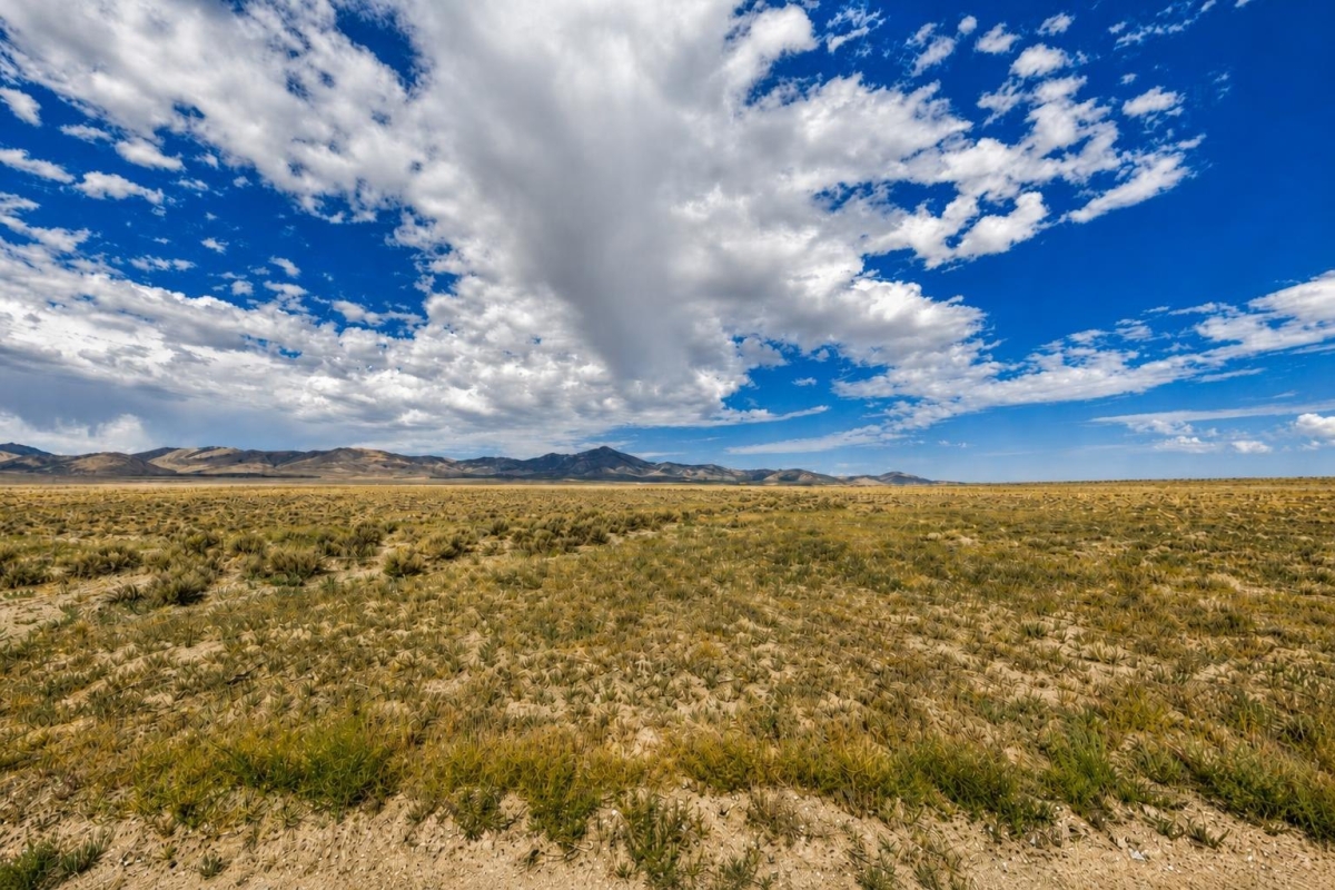
If you are looking for low-entry rural Utah acreage, this Grouse Creek parcel is the kind of listing that deserves a close look and a careful checklist. The price is modest, the acreage is substantial, and the biggest buyer questions are not cosmetic; they are access, utilities, zoning, and official county verification.
The property is LandCentury listing LC25244, a 20-acre vacant land parcel in Box Elder County near Little Pigeon Road, identified as parcel 01-055-0017. The supplied data shows a $8,000 cash price, Recreational zoning, a Warranty Deed, no utilities, and annual taxes listed at $21.32.
The key caveat is that road access is listed as Unknown Road, and the listing data alone does not establish buildability, water availability, septic feasibility, legal access, or permitted uses. A serious buyer should treat this as a county-records and site-verification purchase, not just a map-and-price decision.
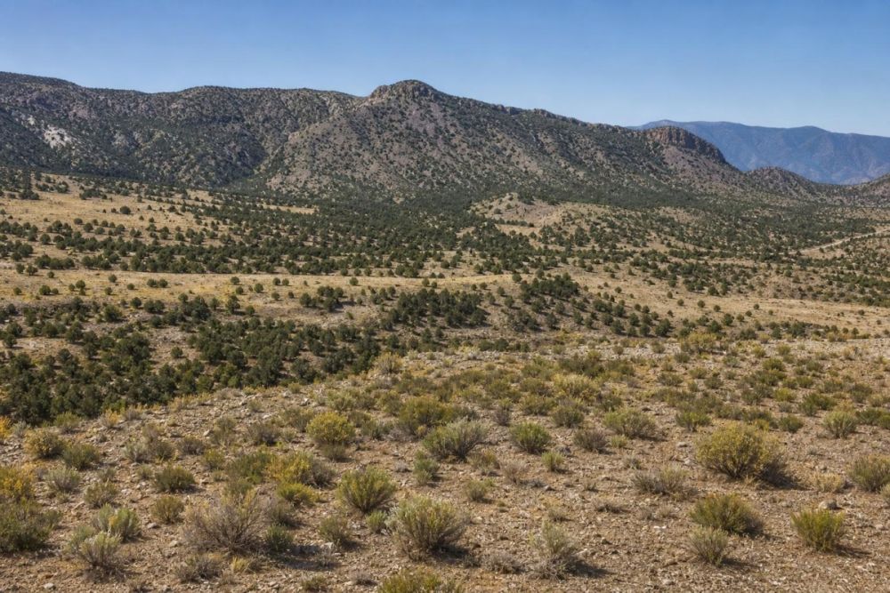
Property snapshot
These are the listing facts that matter most for a rural land buyer, along with what each one means during due diligence.
Use this number when checking Box Elder County GIS, assessor, and recorder records.
This helps connect the listing to recorded documents, mapping, title review, and any survey work.
The deed type is part of the closing picture, but buyers should still verify title, ownership history, liens, and exceptions.
The acreage supports a larger rural-land use case, but it does not by itself confirm access, buildability, or allowed uses.
This is the listed cash purchase price; confirm current availability and closing costs before relying on the number.
Recreational zoning needs county confirmation for camping, RV use, structures, cabins, agricultural activity, or other intended uses.
These are high-priority checks because legal access and utility strategy can determine how the land can realistically be used.
The stated tax figure suggests a low carrying cost, but the current tax bill and any assessments should be verified with the county.
Grouse Creek and Box Elder County setting
The listing places this parcel near Little Pigeon Road in the Grouse Creek area of Box Elder County, Utah, with coordinates shown as 41.218405, -113.799821. Those coordinates are useful for map research, but they are not a substitute for a survey, title review, or county boundary confirmation.
Box Elder County is the local government context that matters for this purchase. The county maintains official mapping, property-record, and planning resources that can help a buyer research parcel boundaries, roads, recorded documents, zoning layers, and development constraints.
For this specific parcel, the important location question is not whether the broader area is rural; it is whether this 20-acre tract has legal and physical access, what Recreational zoning allows, and whether any water, septic, utility, road, flood, or hazard issues affect the buyer’s intended use.

Potential uses: who this land may fit
Based on the supplied facts, this property is best approached as affordable rural acreage for a buyer who is comfortable doing real land due diligence. The 20-acre size and Recreational zoning field may appeal to people looking for space, privacy, outdoor use, or a long-term hold, but none of those possibilities should be treated as guaranteed.
Any use should be conditioned on zoning, permits, legal access, physical access, utilities, water, septic, flood and hazard review, recorded restrictions, and site conditions. The listing’s no-utilities and unknown-road-access fields are not small details; they shape what the land can realistically support.
- Recreational retreat or weekend-use land, if county rules, legal access, camping or RV regulations, fire rules, and site conditions allow.
- Long-term hold for a buyer seeking inexpensive Utah acreage after confirming title, taxes, access, and restrictions.
- Off-grid planning project, only after verifying access, water options, septic feasibility, power or solar logistics, and permitting requirements.
- Low-intensity agricultural, grazing, or open-space use, if zoning, fencing, water availability, access rights, and any recorded restrictions support it.
- Conservation-style ownership for a buyer primarily interested in acreage and low ongoing carrying costs, subject to current tax and assessment confirmation.
Due diligence checklist before buying
This is a rural land listing with several known facts and several important unknowns. These checks help turn the parcel number, legal description, and listing fields into a more reliable purchase decision.
Confirm the parcel in county GIS
Search parcel 01-055-0017 in Box Elder County mapping resources and compare the mapped parcel with the legal description, coordinates, road layers, and surrounding ownership.
Verify legal and physical access
Because access is listed as Unknown Road, confirm whether the parcel touches a public road, relies on a private road, requires an easement, or lacks recorded access. Also verify whether the route is physically passable for your intended use.
Ask what Recreational zoning allows
Do not assume Recreational zoning permits a cabin, dwelling, RV, camping, hunting setup, agricultural use, or storage. Ask the county planning or zoning office about allowed uses, conditional uses, setbacks, frontage, road standards, and permit requirements.
Review title, deed, covenants, and restrictions
Use the parcel number and legal description to verify ownership history, recorded conveyances, liens, easements, covenants, and exceptions. A title search is especially important when buying rural acreage quickly.
Research utilities, water, and septic feasibility
The listing says no utilities. Confirm power proximity, service-extension costs, well or hauled-water options, septic rules, soil or percolation requirements, and whether utilities or access easements appear in recorded documents.
Verify taxes and assessments
The listing shows annual taxes of $21.32. Confirm the current tax year, assessed value, any unpaid taxes, and whether special assessments or changes may apply after transfer.
Check flood, drainage, and hazard context
Review FEMA flood mapping and county hazard or environmental layers where available. If you plan any structure or improvement, confirm whether drainage, geologic, flood, or other site constraints affect permitting.
Consider a site visit or survey
A map review is helpful, but rural land often needs boots-on-the-ground confirmation. A site visit or survey can help verify boundaries, access conditions, terrain, and whether the property matches your intended use.
Box Elder County GIS is the best single official starting point for map-based verification because it can help buyers research parcel boundaries, road context, planning layers, and other county mapping information. Use it alongside recorder, assessor, and planning records before closing.
Financing and payment context
The supplied listing data shows a $8,000 cash price. It does not show an owner-finance price or owner-finance terms for this parcel, so buyers should treat it as a cash listing unless written terms are provided by the seller.
The pricing data also shows a $5 deposit size. Before relying on any payment workflow, confirm what the deposit secures, total funds needed to close, recording process, closing timeline, and whether any taxes, liens, or assessments must be cleared.
- Is the $8,000 cash price still current?
- What does the $5 deposit secure, and is it credited at closing?
- Will a title company, attorney, or direct recording process be used?
- Who pays recording, deed preparation, transfer, or closing costs?
- Are there any unpaid taxes, liens, or special assessments tied to parcel 01-055-0017?
How to compare this parcel with other Utah acreage
The $8,000 cash price and 20-acre size make this a notable rural Utah land listing, but price per acre is only one part of the decision. The practical comparison points are legal access, road condition, utilities, zoning, water and septic feasibility, title clarity, and current taxes.
When comparing this parcel with other Box Elder County or Utah land, give extra weight to listings with confirmed legal access, documented road frontage, clearer utility information, current county records, and written zoning answers. A higher-priced parcel can sometimes be easier to use if major access or utility questions are already resolved.
Questions buyers may ask about this property and area
Bottom line for buyers
This 20-acre Grouse Creek property may fit a buyer who wants inexpensive rural Utah acreage and is willing to do the verification work that remote land requires. The strongest confirmed hooks are the acreage, the $8,000 cash price, the parcel number, the Warranty Deed field, and the very low tax figure shown in the listing.
The biggest open items are equally important: access is not confirmed, utilities are not present per the listing, and Recreational zoning must be interpreted through Box Elder County’s rules. Do not treat the parcel as buildable or ready for a specific use until the county, title records, utility providers, and site conditions support that conclusion.
A smart next step is to review the full listing, save parcel number 01-055-0017, and run the due-diligence checklist before making a final decision.
Interested in this Grouse Creek parcel?
Review the listing details, then use parcel number 01-055-0017 to begin county GIS, records, access, zoning, and tax checks.
Useful research path
Compare the listing against county GIS, recorder and assessor records, planning guidance, and similar vacant land options with different access, utility, or financing profiles.
You Might Like

Cheap Vacant Lots for Sale in Brevard County, FL
Brevard County Florida is one of the hottest places for vacant lots in the country. Situated in the middle of the state and on the East Coast, Brevard County spans...

Looking for Land for Sale in Port Charlotte, Florida?
Port Charlotte has come a long way from chasing wooly mammoths in the ice age. It is now one of the fastest growing residential playgrounds in Florida, and with good...

What Type of Land Is the Cheapest Option You Can Get?
Land is rising in price, but you can find cheap land options if youre willing to sacrifice some of your requirements. Were going to take a look at the cheapest...